Tuesday, August 28, 2012

The Tides - at a lose end.

The Tides
37 39.980 N
76 26.017 W

We needed to attend to a few loose ends before we departed and I needed to pay the bill, so we did not get away till about 9AM. Plus the weather was a bit unsettled, with a "small craft advisory" active till Noon. In the Solomons, the weather was fine, so we set off as soon as we could. We had a big day ahead of us, about 65 NM, so we really needed to get rolling.

The day was uneventful. Early on the wave pattern was awkward and Tide Hiker was "hobby horsing", but that all settled down after a couple of hours. It was hot and humid. Our projected track for the day was mostly made up of three long courses about 15-20 miles each, so it became a bit boring. Our destination was located on a deep creek about 5 miles up the Rappahonic, on the north side. Once we were in the creek it was easy to spot. We called them on the radio and a white uniformed employee was waiting to take our lines.

It was about 6:00 PM and Nick and I were both beat. It had been another long day after 6 long days. We had traveled XXX miles and both of us were looking forward to a break. We had a giant amount of food left over from our Mexican dinner the night before, so I made some rice and heated up some tortillas and we had another feast. Then a bit of TV and bed.

Wednesday August 29, 2012


Beach and pool at The Tides

The morning paper was waiting on our deck when we woke. Cool! And it was a perfect mild summer day, and we explored the resort and we took it easy. The resort is really nice, I am sure Deidre will enjoy our month here. The hotel was built in 1946 for the Washington fat cats and has quite an old style classy feel about it. Plus we are "plugged in" so we will have AC and all the trimmings. There is also cable TV (I have to work that out yet) and WiFi and a free water taxi.

Nick shouted dinner in the dining room, and I half expected the host to require a jacket and tie before seating us. We are not spring chickens by any means, but I expect our seating brought down the average age of patrons by 5 or 10 years. We did feel a bit under dressed. Afterwards we had a beer at the bar and ended up meeting some other boaters and having some fun.


Thursday August 30, 2012


The pool
Nick left for his place in North Carolina this morning. After seeing him off I headed back to the boat to give it a well deserved clean up. It took me four hours to scrub and hose the decks.I started working on the chrome but just pooped out and went for a swim at the pool. I took 6 back issues of Time and relaxed. Back at the boat made , watched a bit of TV and hit the sack


Friday August 31, 2012

Took the 10 AM hotel shuttle into "town". Kilmarnock is only a little place but it has a Walmart Superstore and that was my target. I needed beer and wine (Nick had cleaned me out) and oil (Tide Hiker is due for an oil change) and maybe a few veges. I got the beer and the wine and the veges, but missed out on the oil. Plus I wanted to spec out the town for Deidre who will need to do "a big shop".

The Lounge
This weekend is the USA Labor Day Weekend, so the hotel will be full and there will be some "special activities" including a band in the bar and probably poetry reading in the lounge. Just kidding about the poetry, but the lounge looks like some gentleman's club in London.

I am told the Marina will also fill up, which would mean Tide Hiker will have neighbors, which I would enjoy.


Saturday September 1, 2012


Dinner
As expected, boats are rolling into the marina. We now have a 42' Kadey Crogan on our port side and a beautiful Fleming 55' trawler on our starboard. My social life should now improve.

Today I started the teak cap rail project. The cap rail is weathered and faded. It will need sanding, "cleaning" with a special solvent then several coats of teak oil.

I took some time off to make myself a decent dinner.


Sunday September 2, 2012

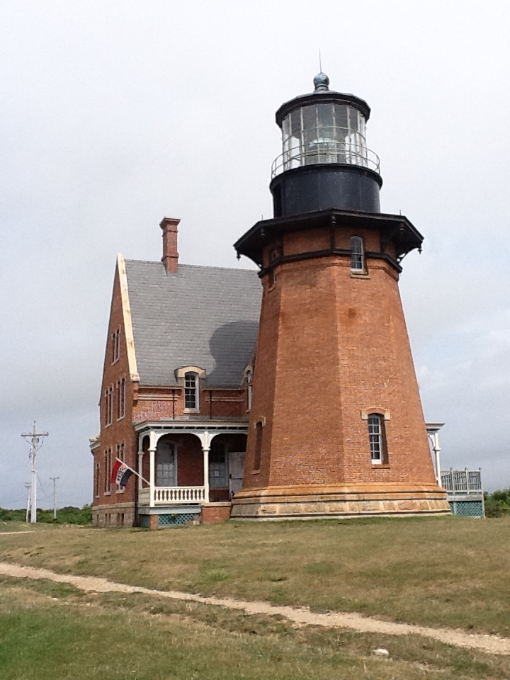
The cap rail project went well, despite inclement weather. The cap rail extends all around the boat. It is solid teak that has been "oiled" rather than "varnished". Varnish seems like a lot of work. (You can see it in the above photo, behind the ketchup bottle.) I had made a half heart-ed attempt to refinish it when we were at Block Island, but it needed more.

Now it looks great. I sanded most of the old surface off and then scrubbed the new surface with "teak cleaner" which really brought out the color. Then two coats of teal oil later, it positively shined. I am sure Deidre will be impressed.

Monday, September 3, 2012

Today is clean-up day - I cannot put it off any longer. I leave in the AM to pick up Deidre. I really hate housework.


Monday, August 27, 2012

Solomons

Washburn's Boat Yard


The rain had kept up most of the night. We checked the weather first thing and storm warnings were posted for late afternoon and this evening. We had about 45 nm to get to the Solomons - about 6 hours - so if we left at 8 AM we would arrive about 2 PM, before the weather changed.

I had arranged to call in at Washburns Boat yard in the Solomons and have them look at the Electro San and    the packing on one of the rudder posts that had developed a leak.We could stay at their dock "for free" so I was motivated.

The morning turned out to be perfect - the sun was out, a few clouds on the horizon, dead flat calm and we had a 0.4 kt current in our favor. We made good time and arrived right on time at 2PM. Before going to our berth at Washburns we picked up 200 gallons of fuel and a pump out at Spring Cove. We were secure at Washburns by 3PM and the mechanic came straight on board.

As expected, the solution to the rudder post leak was to tighten down on the packing. The mechanic was satisfied there was plenty of adjustment remaining. The Electro Scan issue was more elusive. The system is now working on "manual" but not on "automatic". It seemed to be an issue without an easy solution so I decided to drop it for now. (At least till I find an expert.)

Nick and I borrowed the Marina truck and went out for Mexican. We figured this was the best way to be sure the toilet was fixed.

Sunday, August 26, 2012

Annapolis

Sunday
38 58.578 N
76 28.963 W

We woke up this morning to find that one of the trawlers had dragged - maybe 1/4 of a mile - and it was not us! We use an "app" on the iPad called "Drag Queen" to moniter our position at night and we had not heard a peep from it so I was not concerned.

Company
The bottom was not too muddy so recovering the anchor was easy and quick and we were on our way to Annapolis. The other two trawlers followed us out. We had previously arranged to meet Bon Voyage there on a ball. The balls are allocated on a "first come first served" basis so we wanted to get there as early as possible.

The forecast was a bit of a worry - there was a 'small craft advisory" for all of the northern Chesapeake. We are not exactly "small craft" but we are "nervous craft" so I was a bit anxious. All went well till about noon time when it was obvious we were in for some strong storms. The Bay was basically deserted except for Tide Hiker and the two Kateys. We could see the red cells on the radar, so we secured the flying bridge and went below.

Funnel cloud, left of pennant
In the next couple of hours we were hit by several srong storm cells. They rolled towards us over the water like a fog bank, but faster and darker. The rain was torrential, visibility went down to zero so we were navigating by chart plotter and radar. The wind came with each cell and the waves built up to 4 and 5 feet. Apart from the fact that we were concerned about entering Annapolis and grabbing a ball in these conditions, we felt secure and the boat got a good wash. At one point we believe we saw a funnel cloud forming - but there were no reports of water spouts or tornados that night

By 3 PM we were in the approaches and seemed to have an opportunity to get in between cells. We called the Harbor Master and told him our intention and he confirmed the anchorage was open. It turned out to be perfect - the rain stopped, the wind died down and Nick grabbed a mooring ball first try. We secured the boat, gave ourselves a high five, and went below for a beer.

Bon Voyage arrived by about 4:30PM. They experienced simular conditions but with more lightening. And apparently one boat had been struck and lost all their electronics. They took a ball next to us. We packed some chips and beers in a bag and called the water taxi to take us the 40' to BV. Our intention was to go into town for dinner but Bonnie cooked up a wonderful meal of fish and veggies and Jon broke out a few bottles of his best, and a good time was had by all.

We were home in bed by 10 PM. At about 2 AM I got up for a drink of water and a couple of asprin. No scratches (on the outside).


Saturday, August 25, 2012

C & D Canal

Its currently about 7:30 AM Saturday. Not much of a day - overcast, spitting some rain, slight wind out of the east. The wind is forecast to built to 20 kts during the day with gusts to 30 kts. But it will be on our stern quarter for most of the run up the Delaware. We are cleaning up the boat and basically killing time till the tide starts to turn.

The trip up was as expected. For most of the day we enjoyed a push from the tide. The weather was OK but nothing to write home about. We made it to the canal by about 3:00PM and headed west against the current. I had my heart set on spending the night at the free dock, but when we arrived the dock was blocked off for some reason, and we just had to keep going.

Deidre and I had contemplated anchoring in the Bohemia River on the way north. It look protected but shallow. We saw a couple of boats following us so I made contact via radio, looking for "local knowledge". Both boats planned to anchor in Bohemia so we asked if we could follow them in. This we did, and anchored in a rain storm with about 2' under our keel. Three trawlers in a row. It was too wet to be social so we watched TV and went to bed.

Friday, August 24, 2012

Cape May

August 24, 2012
38 57.575 N
74 52. 011 W

We made it to the entrance about 10 AM this morning. Once we got the boat hooked up we both took a shower and a nap.Since leaving PW we had covered 145 NM in 20 hours.

We could not leave PW until about 2PM (because of the tidal current down the East River) so we enjoyed a quiet morning. At about 1PM we took the boat over to the Town Dock and filled our water tanks and used the pump out. By the time we were done we were on our way.

This was the 4th time Tide Hiker had made the trip down the East River and thru New York Harbor. We were very early on the tide so the current was not at its peak. We passed the tip of Manhatten right at peak hour and the ferry traffic was crazy and really stirring up the water. The wind had picked up so it was all a bit unpleasant until we got to the outer harbor and things settled down a bit. We were still riding the tide when we passed Sandy Hook into the Atlantic.

It was now only an hour or so before dark so I fired up the radar and gave Nick his first lesson ("the blind leading the blind") I was confident that we would be able to avoid collisions with boats and ships, it was the crab puts and miscellaneous floating objects i was  concerned about.

The sun was down soon after 8PM and we had an hour or so of twilight. Then the moon came out and that gave some light. But the moon set at about 11PM and then it was totally dark. It felt a bit like Space Mountain" at 10 miles an hour. Spooky.

We decided upon a 3 hours on and off routine and so I went to bed at 9PM. Nick seemed to have a good grasp and I was fairly relaxed and managed to sleep. he had one "incident" with a fishing boat that came over to look at us, but that was it.

I was back at Midnight. Nick had developed a 3 step routine that worked for me too. Check the chart plotter, check the radar (6 sweeps) and then outside onto the Portuguese Bridge for about 10 minutes, staring into the darkness. Once you got used to it, it was quite peaceful. It also pointed out how sensible the the Portuguese Bridge design is for a small boat at sea. Sometime during the night, we began to see phosphorescent animals in the water.There were millions of them, each creating a 1" or 2" circle of light in our wake. Millions of them, quite cool.

I handed over to Nick at 3AM. The lights of Atlantic City had appeared over the horizon. We decided to reduce our shifts to 2 hours so that we would both be up for breakfast. When I re-appeared at 5AM it was still dark, but you could tell the darkness was starting to lift. The weather had progressively settled down. At sandy Hook the sea was confused and rough, but now there were just long smooth swels and the boat moved effortlessly over them.

Deidre and I had visited Two Mile Marina before and I was 100% aware of the current issues. So I avoided the previous mistakes and we looked professions (I am sure!) After hooking up the boat we both took a snooze. The dock master offered to give us a ride into town so we went in for lunch. It is a cool little town, woirth another visit.


.

Saturday, August 18, 2012

Port Washington, NY

Saturday, August 18, 2012

Kathy likes the sun and a book
Deidre and I were up at 7:00 AM having a bit of breakfast and getting the boat ready to move. The weather was unseasonably cold and wet. It had rained a lot during the night. As soon as we started the engines the rest of the crew started to emerge. We pulled out into the gloom and headed around Battery Park and up the   East River. I was hopeful that the weather would clear later in the day.

We arrived in PW at about 11AM and took a mooring ball. What a great service. Deidre and I launched the dinghy and we loaded everyone on board and headed to shore. Kathy needed to be a life jacket for Indy, and I wanted to buy some goggles for my diving set up. We also bought a suction handle to help when we clean the hull. It was a successful trip.

The clouds started to break up and the sun came out. Back at the boat we pumped up "the tube" and I set up the dinghy to tow. We were in the anchorage and there is a 5 MPH limit, but the two nips were a bit bored with it. So silly old grandpa could not resist and sped up. Within minutes the police boat was after us. Grandpa got ban earful from the nice policeman, but other than that no damage. Phew!

Grandpa under the water
I have been accumulating a complete dive set up, but wanted Adam to be there to get me in the water. This was achieved in short order and I had my first tentative dive. All went well, except visibility was virtually zero. Tomorrow we plan to go further out into the sound to swim, so I will dive again tomorrow.in clearer water.

By now the whole family was in the water behind the boat. The weather turned out to be perfect. The day started to meet our expectations. That evening we all loaded into the dinghy and went into town for dinner. The food was average, the service was terrible, but Adam "shouted" so I was as happy as a clam.

Sunday August 19
Indy taking a break

Today we decided to move further out of the bay so that we could get the kids tubing out of the 5 MPH limit. It was not much of a day - intermittent sun with a breeze, but this was Adams last day and I wanted to have some fun  in the water.. We went a couple of miles to a bay with a beach.

We took the kids to the beach in the dinghy, but it was a pretty rough beach, so after a quick walk we were back at Tide Hiker. I set up the dinghy and tube, and off we went. It was a bit rough, and the first circuit we attempted the kids did a face plant and ended up in the water. The kids made no fuss, but obviously the weather was not right so we reverted to playing in the water.

We were back at our ball in time for Adam to take a shower and pack his bag and take a ride to the shore in the dink. He called an hour or so later, safe at the airport. In the mean time we had fired up the bar-b-que and enjoyed chicken and brats for dinner.

After dinner Deidre received a call from home with the sad news that that her Dad had passed away the night before.

Monday August 20, 2012


Happy Photo
Contrary to the forecast, it was a perfect day. Lots of sun, maybe 75 degrees, no humidity. We went into town to check out the train schedule at the LIRR railway station  because Deidre and I will be heading for JFK on Tuesday. Deidre is booked to fly back to Australia starting in New York on Tuesday, arriving Thursday morning Australia time. I have arranged for a great friend of ours - "Nick" Nicholas to join me on Tide Hiker on Wednesday. Nick and I will take a week or 10 days to take Tide Hiker back to the Chesapeake. We had a bite of lunch in town and then made it back to the boat for a swim.

Kathy managed to bring her flight home forward one day, so she and the kids will leave early Tuesday morning. That will give me most of Wednesday to sort out the boat and be ready for 10 days of cruising with Nick. (I sure hope he learns as fast as Deidre!)

We have arranged thru a friend to dock Tide Hiker at "The Tides" in Chesapeake for a month, starting about September 1st. Deidre will be back September 4th, so I will need to rent or borrow a car to drive up to NYC to pick her up.

Tuesday August 21, 2012

Sad day - we took Kathy and the two nips to the Town Dock where a cab picked them up. We are now getting ready for Deidre's departure about 2 PM. The washer and dryer are busy.

The water taxi picked up Deidre and I at about 2PM. We had a cab waiting at the Town Dock and were at JFK 45 minutes later. The check in was easy and we killed half an hour with a cup of coffee, but then it was time for her to go.

The cab and tip cost about $75 so I was determined to take the train home. It was a bit convoluted but it only cost a total of $11 - and took about 2 hours. I was back on the boat by 7PM. And her I am still.


Friday, August 17, 2012

Liberty Marina, NJ


Friday August 17, 2012
40 41.679 N
74 05.047 W

Our "black tank" light was showing red, even tho we were pumped out Wednesday morning in Oyster Bay, so we called for another visit this morning. The light went green for an hour then reverted to red ("Tank near full") so I assume we have a problem with the gauge. No biggy, we will be out of this "No Discharge" zone in a week.

Better photo of Wall Street
We left at 10 AM, dinghy back on board, our departure timed to catch the tide down the East River. There was a strong breeze in our face, apposing the current, so there was a bit of a chop. It is a spectacular but quite a wild ride. The only issue we had was catching up with slower yachts - Tide Hiker needs to be making way thru the water to be under control.

We were secure early in the afternoon and spent the rest of the day cleaning up and preparing for our visitors. They took a ferry over the Hudson and arrived at about 6PM. The kids were excited to see the boat and their cabin.

Adam and I bar-b-qued dinner on the boat deck. We were all in bed at a reasonable hour because we had an early start in the AM.

Wednesday, August 15, 2012

Port Washington, NY

Wednesday August 15, 2012
40 49.732 N
73 42.685 W

I had my days mixed up and forgot that today we were to move on to Port Washington. By the time Deidre reminded me it was a bit late, so we left in a bit of a rush. The weather did not look great, either. We decided to tow the dink because it would save a bit of time.

It was only a short trip, but there was one of those "red cell" storms working its way towards us and I was a bit concerned having the dinghy in tow. If it rained, it would fill up with water and if the water got rough it could flip. It is a "rigid inflatable" so it would not sink altogether, but I could imagine (I am good at imagining the worst possible outcomes) the tow line ripping the cleat out of its bow.

Port Washington likes boaters and the town provides 25 free moorings. We took one and next day we spent $400 plus in town at the super market, the marine store and a restaurant. So I think we paid our way. The bad part of the storm missed us but it rained all night..


Thursday August 16, 2012
Perfect weather today. We enjoyed the day and got a lot of jobs done.

We had dragged the dinghy behind Tide Hiker from Northport to Port Washington (never again!) and so it was already in the water. After pumping out the 1,000 or so gallons of water it had accumulated from rain and spray we headed to shore to shop. This town was the perfect setup. There was a new and free and easy to find dinghy dock. The dock was on the main street, right across the road from a large supermarket. And a West Marine just around the corner. We did a massive shop, and carted it down to the dock in the shopping cart. Deidre got on board, and then I passed bags to her till she disappeared. We repeated the process in reverse at the other end.

After a break we took the dink to a different dock, closer to the Post Office. It was still at least a mile walk, and mostly up hill. On the way we called in at the bank (to get a statement) and a liquor store (to talk to the manager about the evils of alcohol.) Our mail was waiting for us so we were very happy! On the way back we speced out a restaurant for dinner.


Tuesday, August 14, 2012

Oyster Bay

Tuesday August 14, 2012
40 52.695 N
73 30.612 W

Another lazy morning. I was not out of bed till 9:00 AM. My throat was still sore but not as bad as last night. We took it easy and tidied up the boat (Deidre vacuumed) and did not leave till almost Noon. The ride over to Oyster Bay was only about 15 miles. The weather was calm but there was rain around.

Oyster Bay is only about 44 miles from Manhattan, as the crow flies. It seems to be one of those "life styles of the rich and famous" places. The houses built on the hills surrounding the bay are quite extraordinary. I wonder how many are "upside down" on their mortgages?

We are now anchored and it is poring rain. But rain without wind, and that is nice. Gives the boat a bit of a wash and its nice to listen to as it hits the canvas. When the rain storm passes we intend to launch the dinghy and pay the village a visit

Monday, August 13, 2012

North Port

Monday August 13, 2012
40 54.720 N
73 22.127 W

There are good days and there are "not so good days" but this has been a great day. Today has been what cruising is all about. Its currently about 6:30PM, I am sitting in my pajamas at my computer, the sun is streaming in the door (the blinds are down in the salon) the sea is calm, it is about 80 degrees and there is no humidity. And I have a cold beer.

Loading water!
We took it easy this morning in Port Jefferson and did not get underway until about 10AM. First task was to pop over to the marina and pick up some fresh water. That done, we headed out the channel. It was a nice morning, sunny with west wind 5-10 kts. We were only going about 20 miles, to Northport, the forecast was clear, so there was no hurry. We are now specking out places to bring the kids, and Northport had been recommended.


Up to the daylight
The town dock in Northport is free in daylight hours ($150 overnight!) so that is where we were headed. There was plenty of room and even a dock person waiting to help us tie up. The tide range in Northport is about 8 feet and we arrived at low tide, and so all we could see was underneath the dock. There were wooden ladders running up the side of the boat. It is amazing what Deidre has adjusted to!

We headed into town. It is a nice place, with a shore front park and a play ground. Good for the kids. We walked up and down the Main street and came across a Chines Restaurant. Deidre had a wicked suggestion: "Lets buy take out and eat it for dinner when we are anchored?"

We left the town about 5:00PM and headed out to the anchorage. The area was wide open so anchoring was a breeze.  
It was still a balmy 80 degrees so Deidre and I decided to take a swim. No nettles (jelly fish) in Long Island Sound. We dried off on the bow in the evening sun. By then we were finding our appetite so the Chines feast was on. For $18 we had received buckets of food. We sat at the table on the aft deck with the screens down and tucked in. Unfortunately the food was only average - lean and fresh, but no flavor. And we had enough for another 2 meals.

We watched the last episode of "The Closer" and the first episode of "Major Case Squad". By then my throat was on fire and we retired.

Sunday, August 12, 2012

Port Jefferson

Saturday August 11, 2012
40 57.019 S
73 04 236 W

Friday night Deidre and I were just too dysfunctional to decide where to go in the morning. There were storms in the forecast for Saturday and we were concerned about spending another night in the Block island anchorage. I just wanted OUT. So we went to bed with no firm decision for the next day, just that we were leaving.

We did agree that we needed a pump-out, so first thing in the AM we radioed the pump-out-man. Long Island Sound is a "No Discharge Zone" so even if you have a sanitation system (we do) you still cannot pump the net product over the side ("But officer, it is cleaner when we pump it out than when we pump it it!" No matter, its a $1,000 fine.) The pump-out service at Block Island is free. The operator works for tips and we gave him $5.00 - worth every penny!

We were still contemplating our destination next morning as we left so I had to make a decision and I made the most conservative one available.

We were expecting bad weather, so I would prefer to be under way. I wanted a secure place for the night with an easy entrance in all weather. So I decided to head all the way to Port Jefferson. It was 60 plus miles away. It would be a long day.

Sure enough, there was a big summer storm soon turned up on the radar, approaching from the south west. We watched it as it slowly moved north-east towards us. It had plenty of "red spots" in it but was sorta "long and narrow". We were heading south west, just keeping out of its reach as it moved north-east. There was plenty of wind, the sea was slate gray, and the wind was blowing the tops off the waves, but no rain and no big gusts. We abandoned the flying bridge and went below.

The Pilot House feels very secure. It has great 270 degrees of visibility. It is in the center of the boat so the boats motion is minimized. We have the radar on one screen and the chart plotter on the other, and steer using the auto pilot. But most important, it is closer to the galley!

Tide Hiker was handling the weather well, although we were only making 7 knots into the wind. Deidre started "not feeling well" and went below to get the ginger and have a snooze. We continued our "end run" around the head of the storm. By 1 PM we had made it into the lee of Long Island and the swells disappeared, but there was a 3' - 4' confused chop and we were still getting spray on the windshield. Deidre discovered we had left the porthole in the forward head open, and the whole room was wet.

Admiral spotting the buoy
We called the Jefferson Harbor Master and ordered a buoy for two nights with an ETA of 7.00 PM. We arrived right at slack so the entrance and picking up the buoy was easy. The storm passed us to the east, Deidre made a great salmon and bacon salad that we ate on the aft deck. We found a movie on the TV, but were just to tired and hit the sack early, and slept like logs. The storm missed us to the east.


Sunday August 12

I woke up with a sore throat. The price of the buoy included the water taxi, so we went ashore for breakfast and a paper. We met a couple from Manhasset on the taxi, and decided to breakfast together. It gets lonely on the boat, and a bit of company is fun. We mailed some letters and now we are back on the boat for a quiet afternoon.


Thursday, August 9, 2012

Block Island and Fog

Thursday August 09, 2012
41 11.503 N
71 34.677 W

Exciting day today and no scratches!

We were up by 6:15AM and underway by 6:45AM. It was a beautiful misty morning and the water was like glass as we retraced our path down the creek. We had about 50 nautical miles ahead of us and we immediately picked up speed with the tidal current as we turned east. We hope we had started early enough to get at least 5 hours of "push" from the tide.

The forecast had called for "areas of fog". An hour or two after entering the Sound we started to notice a dark cloud flat on the ocean, and soon enough we were in it. It was as thick as the proverbial pea soup, and visibility was probably down to a 100 yards. We retreated to the Pilot House and fired up the radar.

We had experimented with the radar a couple of times just to see if it worked, and I had flicked thru the Users Manual so at least we knew how to turn it on, but not much more. Now it was for real as the fog really closed in. Also, the boat is equipped with a "hailer" that will automatically act as a fog horn. I got it going, and we were soon emitting a 5 second blast every 2 minutes. The tide was now giving us a knot and a half push, so we were moving over the ground at a consistent 10 knots.

Anyone there?
We had been planning to follow along the north coast of Long Island to Plum Cut, turn South thru Plum Cut (between Long Island and Plum Island) and then revert to an Easterly course into Block Island Sound. Plum Cut has a bit of a reputation for unpleasant tidal currents that cause rips and standing waves. The opening only seemed about 1/4 mile wide with rocky shore. All of the "notes to sailors" contained all sorts of dire warnings. We decided to give it a miss, and continued "the long way" and make the turn East at "The Race"

On a "normal day" we don't seem to see many boats. Now in the fog we saw boats everywhere. The radar was set at about 5 miles range. As we "saw" boats approaching from our bow we let the situation unfold till about a mile, when we made a course change to avoid passing too close. The "rules of the road" suggested both boats would "ease" starboard so we would pass "port to port". This worked fine except for one occasions when the oncoming boat kept on turning towards us as we adjusted our course. They were coming at some spreed, we had already turned 40 degrees and I did not want to turn any more and present a bigger target. We slowed down and started blasting our air horn (5 short blasts "imminent collision") as the radar showed them virtually on top of us. In a flash they came out of the fog, moving at 20/25 knots, 50/100 yards away, making a hard turn to their port (the wrong bloody way again) and then quickly disappearing into the fog. It was a 28'/32' sport fishing boat, with radar.

After a quick change of underwear I was back at the helm. We were still making good time, despite all the course changes and figured we would reach Block Island by 2PM. The charts show Block Island has a large "inland" anchorage reached by a man made channel. We were a bit thoughtful about making the channel in the fog as it was obvious by now there was a lot of boat traffic. But lo and behold, the fog lifted about a mile from the buoy, and it was an easy run in.

The anchorage
The site that greeted us as we reached the anchorage was amazing. It was full of boats - literally hundreds and hundreds. Mostly sail boats in the 35 - 50' range, but a smattering ow power boats also. We were amazed. The guide indicated that one of the towns offered 50 mooring balls, and we had hoped to grab one. Fat chance. It took us 30 minutes of wandering around to find a space to anchor in, and 3 attempts to do so.
(Its hard to photo and anchorage. You end up with a lot of sky and water)


Friday August 10, 2012
"Good and bad" but no scratches on the boat (that I can see!)
Block Island Dinghy Dock
The day started so well. Deidre made French Toast with strawberries. We then put the dinghy into the water and headed to the shore. The "old town" is about 2 miles from the dinghy dock, which is more than we wanted to walk,  so we took a cab. "Old town" was busy with tourists, arriving on the several ferries. Lots of tee shirt shops and places to eat.

Sometimes we feel a bit "uni-modal" so we decided to rent a little "smart car" for a few hours and tour around. It was fun, and we explored the island, though the car was dirty and needed love. We were also able to track down a "friend" we had made in South Carolina who was bar tending here. All good fun.

We were back on board by about 2PM. The boat has been feeling increasingly damp, so we decided to run a generator and turn on the AC and get the humidity down. We were expecting a front and some rain, so we thought the timing was good. I had a New York Times, plus a bit of work to do. We left the dinghy in the water so we could run back to the shore for dinner.

The front and the rain arrived on time. Unfortunately it brought some strong winds with it. Boats started dragging. Ho hum, we had our Delta 88 firmly planted with about 200' of chain, so no probs for us. WRONG. We started dragging badly, people started yelling in our direction. There were lots of boats in the anchorage so collisions were happening. We got the engines running, avoided collisions, and got the anchor up - no mean feat. The chain went into the locker, mud and all. The wind was blowing, the rain was pelting down, we headed into the right of way to wait it out.

Deidre and I were saturated. The boat was saturated. And I was deflated. Obviously I need anchoring lessons. We did laps up and down the fairway until the wind eased. then went back into the anchoring field and picked the spot. I could hear peoples reactions "Oh no, not them again!"

We have decided to leave in the AM. There are more storms predicted for tomorrow, and I just do not want to be anchored in such a confines space.


Wednesday, August 8, 2012

Mattituck

Wednesday August 8th, 2012
40 59.701 N
72 32.362 W

We took the dink into the marina to meet our "new friend" Eric on time. He was nowhere to be seen, so we immediately adjusted to "Plan B" - out for breakfast! After a couple of inquiries we found a place and breakfast was great. Eric called us an hour or so later - perfect timing. He jad the part and had installed it. All he needed now was $30 for the part. So for a meager $255 we were all set.

We quickly made it back to the boat, hoisted the dink and were under way by 11:30. It was going to be a short day, but Eric had suggested a little port called Mattituck, maybe 30 miles away. The town was a mile or two up a little creek and there was a small anchorage at the head of the creek.

Hmmm seems close?
So here we are. The anchorage is minute, and there are a couple of yachts already anchored. We squeezed in, backing down so far that I can almost reach the bow pulpit of a sailing boat behind us. So much so that the occupants came over in their dink to complain - so we invited them in for a couple of beers and I agreed to shorten our anchor by a few feet. We exchanged phone numbers and parted friends.

We are heading to Block Island early in the AM. We have to catch the tide down the Sound and get thru "The Race" at near slack. Should be fun.

Tuesday, August 7, 2012

Jefferson Harbor

Tuesday August 7th, 2012
40 57.345N
73 04.981W

We only had a general plan for today when we went to bed last night. There seemed to be a long strech of coast without any interest, so we thought we would run all the way to the Plum Island cut, and anchor in Gardiner Bay near Greenport. We did not do our homework, with the result that after about 1 hour of running this morning we had to abort and cut the day short. There was just no way to go the Plum Cut safely.

This part of the world is just different than where we have been to date. There are a lot of rocks and a lot of currents. Less room for mistakes. Plum Cut had a dangerous rip and lots of submerged (and not submerged rocks) and could only be navigated by a boat like ours ("under-powered") at or close to slack.

So we cut the day short and went into Port Jefferson. It is a busy ferry port and looked safe and fun. We thought of taking a ball but they were expensive - $50! So we found a decent place to anchor and called it quits for the day. I promised Deidre we would put the dinghy in and go into town for dinner. So we set off in the dink at about 4:30 and 100 yards from the boat it conked out and would not start - not even turn over! We quickly grabbed the paddles and made our way back to the boat. I spent 30 minutes on the problem - looking for a lose wire - no dice.

Once back on board we started calling mechanics/marinas in the area looking for a solution. One guy called back and said he made "boat calls" and he could be at our boat in an hour. One complication - $225! But we needed the dink (grand kids in 8 days!) and I relented. "Eric" was good to his word and arrived within  the hour, and diagnosed the issue in about 30 seconds! What is is to KNOW and UNDERSTAND! I am so envious, I just wish I had the time to go to "everything that works school" so I am not so helpless.

Bottom line was that we needed a part, and Eric had one at the shop. So we arranged to take the dink into the marina in the morning and meet Eric who would install the part. he showed me how to get the motor running by shorting out a couple of wires. I handed over the $225.


Monday, August 6, 2012

Lloyd Harbor

Monday August 6, 2012
40 54.821 N
73 26.398 W

Did I mention previously that "some parts" of New Jersey remind me of Eastern Europe in the 60's? This morning we wanted to get away early but in practice could not leave until 9AM because we had to "return the key or lose our deposit" and the office did not open till 9AM. These guys do not seem to realize that "time and tide waitith for no man!"

So we were out the gate soon after 9AM and crossing in front of Battery Park moments after. We had made a big effort to understand the tides and the current, and figured we had about 3 hours to make it thru to the LI Sound with a favorable "flood" current. (For my non-nautical readers, let me explain. The ebbing and flooding of the tide causes currents. The bigger the body of water behind the tide, the bigger the volume of water that has to move. The smaller the channel, the faster that volume of water has to move. Well, Long Island Sound is BIG, and the Atlantic Ocean is BIG, and all the western Long Island Sound tide flows thru the east River. I have seen tidal rapids in the East River that are 6' or 8' high.)

Heading up the East River
As soon as we made the turn we started to speed up. We normally travel about 7.5kts. Shortly after entering the river we were doing over 10.0 kts and that sped up to13.5 kts in places.  It would have been fun if I had not been so nervous. Also, when all this water hits things that do not move - like bridge abutments - it reacts rather violently and it can be hard to control the boat.

I wanted Deidre to take photos, but I also wanted her to continuously walk me thru the navigation, like: "We are coming up the the first buoy for Roosevelt Island. It is rocks behind it. You need to start moving over to the west to make it past" etc etc. Adding a bit of extra stress were all the river cops! They were everywhere in their fancy boats. We had to pass the United Nations building, and also the end of the LaGardia Airport runway - both heavily policed.

Well behaved barge
First, we passed under a procession of bridges. (Manhatten has a resident population of about 1.8 million, and a work day population of about 6.0 million. The difference cone to work over these bridges and tunnels.) First the Brooklyn Bridge, then the Manhatten, then the Williamsburg and then the Queensboro. We had also been warned that "some people" liked to drop things like concrete blocks on passing boats, and had been advised to change course several times as we went under. Ha, the boat was doing that all by itself! Then, between the Manhattan and the Williamsburg a barge "suddenly appeared". In theory we should all pass "port to port" but he had to turn to do so, so I had to wait, and that kept our attention for a long 5 minutes. But he did, and all was well.

Under one of the bridges we hit something. There was a big THUD and a bit of a shake. We were well clear of the abutments and could not see anything in the water as we passed. Deidre thinks it must have been a body. Maybe we will see it on CSI in a few months.

Looking back at the QB and the cable car
Right before the Queensboro Bridge is the United Nations building, and right after the bridge is the cable car and the Rosevelt Island apartments where we lived back in 1976. The Island looks totally built-out now, but it looks well cared for and with plenty of gardens and trees. Probably still a great place to live.

Passing the end of the Island put us into "Hell's Gate". The current here was the most awkward, with several places where the current was welling upwards, as if a giant water main had burst under the river. No probs, we were almost done.

Once thru Hell's gate the river started to settle down and all was "smooth sailing" although still at a handy clip. Once we passed under the Triborough Bridge we were officially in the Sound and the current dissipated.

Sunset, Lloyd Harbor
Hearing of our schedule a "friend of a friend" offered us use of their mooring in Lloyd Harbor. This destination would make our day about 45 miles and be a nice change from Jersey City. We plugged the co-ordinates into the GPS and by 2:30 PM we were secure. The anchorage was just outside Huntington Bay, a popular boating spot, so we launched the dink and took a ride into town for dinner. We were back in time for a great sunset.

But internet access was bad!


Sunday, August 5, 2012

New York and New Jersey

Sunday August 4, 2012
40 42.687N
74 02.532W

We are now sitting in a slip in New Jersey, just off the Hudson River, just a little south of Jersey City. Deidre can see the Statue of Liberty thru her galley window. (When Bryce sends me the satellite image, you will be able to see how close this is to the river and Manhattan).

We needed to get under way early this morning in order to catch the tide thru the narrows and up into the Harbor proper. Plus I wanted to load up with diesel before we got into "the land of expensive everything" and we had identified a reasonable price ($3.72 gallon) in Atlantic Highlands, a few miles away from our anchorage. So we were up at 7:00AM and were underway shortly thereafter. We took on 411 gallons at Atlantic Highlands and made it to under the Veranzano Bridge by 10:30AM.

(Deidre's camera failed a few days ago. We have not been able to bring it back to life. So we will be running thru New York and up the East River (past our first home in the USA and where Adam was born) camera-less. We are taking some photos with the iPad, but I have yet to figure out how to get them from there to the blog.)

Our view of Manhatten opened up as we passed under the bridge and continued up the harbor. There were a few anchored ships, the Staten Island ferries were running, a bunch of pleasure craft and parked barges, but otherwise the harbor was nice and quiet. We made a close pass on the Statue and Ellis Island, and reached the tip of Manhatten to see the new XXXX building about 3/4 complete. The canal to our marina was only another mile or so, and since the weather was threatening again, I decided to get to our slip.

I must admit I am a bit "torn" about the Jersey side of the river, maybe I am a bit prejudiced. When we lived in NYC back in 1970's the Jersey side was a pretty gritty place, and Jersey City was dump. New Yorkers held Jersey in total scorn. Our arrival today did not do much to change my negative feelings.

The usual procedure for an overnight ("transient") dock is to call before you arrive (using the radio or cell phone) and the Dock Master assigns you a slip, tells you where it is and meets you there to take lines. You then call into the office to do any paper work. Not in NJ! "Tie up and the fuel dock and walk over to the office" was to be the process. Twice the effort for the same result. And the place is grungy - the "office" is a trailer, the fingers are old and grungy, the fuel dock is an old barge, the water is littered with junk. To pay $150 to tie up for 20 hours in a place like this bugs me. (Hilton Head was $100 and was a resort!)

We had been seriously on the move for a week or more and needed supplies. As previously reported we had tried in Atlantic City (New Jersey again!) with no luck. So we grabbed our folding trolley and headed out into the wilds of Hoboken and Jersey City. Step #1 was make it thru 1/2 mile of moonscape to find the "light rail" station ("tram car") and ride it to Harsimus Cove. This we did, and our opinion of "new and improved" Jersey City shot up with every corner. My goodness how the city has changed. My guess is that gentrification is only a few miles away from the marina and our next visit may


Thursday, August 2, 2012

Atlantic City (out of sequence!)

August 1st, 2012

(Note: For some unknown reason this blog is one day out of order. I have no idea how to fix it!) 

The folks in the Nordhavn wanted to leave "early" so we were underway at 8:30 AM - early for us. Getting away and thru the lifting bridge was easy. We were only a mile from the opening to the Atlantic so before we knew it we were on our way in the big stuff. But the weather was mild and it was a comfortable ride. We went north east out to about the 50' isobath and turned North.

It was an uneventful ride. Soon after we left we could see the Atlantic City casinos in the haze on the horizon. We averaged about 7.5 kts and arrived about 2:00PM. We had researched possible marinas in Atlantic City. Anchorages seemed few and far between - and I wanted to focus my energies on the Atlantic and not anchorages. I had found a $1.50/ft at docks managed by the Aquariam. They did not have a dockmaster and were hard to reach, but my experience collecting money for 30 years paid off and we made the reservation and even arranged for the cashier to meet us to take our lines.

We were told that the dock was in the Historic Gardner Harbor. We arrived to find the dock in an interesting location, surrounded by tourist boats, restaurants, next to the Aquarium and just up the way from the clam fishing fleet. I like that sort of environment so I was happy as a clam.

We stood in line with the visitors to the aquarium to pay our bill, then went walking in search of groceries. In the 1970s Atlantic City was a faded and forgotten seaside resort, well past its prime. In fact, a real dump. (Do you remember the movie?) One of the arguments to put the casinos there was the economic stimulation, and a % of the tax revenue was to be spent on urban revitalization. That is the area we walked thru.


New York (Almost!)

Thursday August 2, 2012
40 26.562 N
74 00.029 W

We are anchored behind Sandy Hook about 15 nautical crow miles from Battery Park. Not quite downtown, but we must be close as we are getting about 75 broadcast TV channels and great internet access. We are happily watching the Olympics as I write this.

Sunrise out of Atlantic City

We had about 85 miles to cover today so we planned an early start. We were in bed by 8:30PM and out by 4:45AM, and underway by 5:30AM. Sunrise was not until just after 6:00AM but with a full moon and the lights of the city we could see perfectly well. The water was like glass, the sky was 100% clear, and we were heading east into the sunrise. Magic.

Deidre's camera has conked out (we hope it is the battery) so our only photos we taken on the iPad.

There is not much to say about the trip except that it took 12 hours. The boat ran well, we averaged about 7.1 kts, we must have had some tidal flow against us. When we made the turn around Sandy Hook we got up to about 10 kts with tide, and strange as it sounds the speed scares me!

What can I say?
We had planned to anchor just off the Coast Guard Station, but just could not find a clear spot, and ended up another couple of miles up the Bay at Horseshoe Cove. It's not great, but its good enough. We plan to stay here tomorrow to "catch up" on sleep and boat duties.

Sandy Hook 
Friday August 3, 2012

We stayed up late and watched the Olympics and did not get to bed till 11PM. The forecast was for 5 - 10 kt winds, but it seemed to be blowing a lot harder than that, so I checked the anchor a couple of times and set an anchor alarm before we went below. We both slept well and I did not really wake up until 9AM. The weather had settled down during the night, and the morning was quite foggy and hazy. It is now 11AM and we still cannot even see the Verenzano Bridge.

We are going to spend today resting up, planning and some PM. (And maybe a swim) We have been under way six straight days and covered a lot of water - I estimate about XX miles.

Sandy Hook'
Saturday, August 4, 2012

We decided to stay another day. The weather is a bit iffy and I wanted to better understand the tidal currents in NY Harbor, and needed to do some research. The currents get up to 5 knots in the East River, and in Tide Hiker that is a lot. Maybe I was just being lazy. Plus we had great TV reception and could watch the Olympic Games. And the anchor was already set and holding well. So we stayed.

Mind you, Deidre was a bit stir crazy by the end of the day.