Wednesday, September 30, 2015

Lutz Creek Anchorage

Wednesday September 30, 2015
36 14.459 N
75 55.538 W

We have a new variable to deal with - "Joaquin" is now a hurricane and aiming at North Carolina. Our plan this morning was to head south ASAP and hope that the storm stayed off shore so that we would get south of the storm before it made landfall. But the forecast track is now aimed at North Carolina. So we have made a reservation in New Bern where we "rode out" Sandy. New Bern is 3 long days away but we can arrive Friday night, 24 - 48 hours ahead of Jaoquin. Will be an interesting week.

This morning we took on 497 gallons of diesel at $1.92 a gallon! This delayed our departure until 10 AM, and we were delayed more at the Great Bridge lock and then at the Centerville lifting bridge. For the first few miles we had plenty of company, but they all "peeled off" along the way and we were on our own again.


There was a line at the lock - then a barge came out!

The line up of big guys at Coinjock. Too spoiled the anchor.

Ten miles past Great Bridge and we feel like we are back into the wilderness. The East Coast of the USA is really quite amazing - one minute in civilization, next minute in the Amazon. It is really beautiful and primitive country to travel through.

We pushed on until 5:30 PM but only made 43 NM in total. That leave two big days to get to New Bern. Anchored in the North Landing River for the night. Its calm now, a wind change is expected about midnight. The weather looks a bit spooky, lots of lightening around.

TV reception was pretty good. But when we muted the TV we started to hear noises. Looking out on the aft deck we discover millions - billions? - of bugs. Their combined wing beating noise is noticeable. They are too thick in the air to go out to close the aft cabin door. We made sure all the screens were in place and went to bed.


Top Rack - Marina

Tuesday September 29, 2015
36 44.374 N
76 17.773 W

The forecast is not great so we want to get out of the Chesapeake ASAP, so another long day today. After a very peaceful night we were underway soon after 7 AM. Target was the Top Rack marina where we can get fuel and stay overnight. Top Rack is 15 miles into the ICW in the Norfolk area,

The sea conditions started a bit lumpy and the wind started to build as the day progressed. Unlike Monday we seemed to have a current against us most of the day. Tide Hiker was making a lot of spray.  On a whim Deidre decided to check below, and found that I had left the forward head porthole open and the room was "swimming".

About lunch time we stumbled over a couple of US hovercraft doing their thing. I took lots of photos and a video that I will show below. You could hardly see them because of the rough weatther and consequent spray.

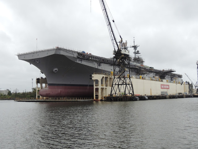
As we approached Norfolk the Coast Guard warned boaters that an aircraft carrier was underway - it was not really an aircraft carrier - just a large "Amphibious Landing Craft" called the "Wasp". We were into Hampton Roads by about 2 PM and started to benefit from the protection, although the scene was pretty bleak. - grey clouds, grey water and grey war ships. And it was raining on and off.

We had to pass two lifting bridges to make it to Top Rack - both N&S railway bridges. (There has been an enormous effort over the last 10 years to replace all the lifting and swinging road bridges over the ICW, which saves time and money for everyone. But not so with the railway bridges.) We made it thru N&W #5 OK but not N&W #7. We waited for two trains, but then it broke down. All in all we waited for an hour.

Top Rack has a great deal - if you spend your slip fee at their restaurant, dinner is on them. And its a nice restaurant. So after we settled in (we were so late that there was no-one there to help) we took a shower and headed in for dinner. This is a "proper restaurant" - no pub food here.

Back on Tide Hiker we had cranked up the AC and it was cool and dry on board when we returned. We even slept with a blanker.

Bob: "How does the captain see where he is going?"
Deidre: "Keep out of his way!"

The "WASP"

Another one.


Monday, September 28, 2015

Fishing Bay Anchorage

Monday September 28, 2015
37 32.084 N
76 20.145 W

Underway from Washburn's about 7:35 AM. Cavara delayed 30 minutes by a worn fan belt. Conditions were fine and we seemed to have some tide assistance most of the day. Dropped anchor in Fishing Bay at about 4 PM - 61 NM in 8 1/2 hours. Good going.

Sunday, September 20, 2015

Solomons (Washburn's Boat Yard)

Saturday, September 19, 2015
38 19.958 N
76 21.526 W

Pleasant 44 NM run south to "The Solomons". This is a large boating center, nobody seems to know why. There are no big towns close by, the area is really quite isolated. There are several big marinas and several boat yards. We are here to get a few things investigated and fixed up that are "above my pay grade". My biggest issue is the #2 generator that bogs down way below its rated capacity. Other jobs:

1. I cannot get fuel to flow out of the stb-aft fuel tank. The three other tanks are down to about 1/4 full, but the stb-aft tank is chocker. As a result Tide Hiker has a weird list.
2. The stb exhaust hose in the ER is running too hot. I am thinking maybe the elbow is clogged somewhat?
3. The sport transmission control cable on the flybridge is out of adjustment. Leaving Boston we were running on one engine and did not realize for an hour or so that the port transmission had not engaged.
4. I have ordered a new control cable for the Glendenning. It needs to be installed. I could probably do it, but since there will be a mechanic in the ER......
5. The gasket behind the mechanical fuel pump on the Onan is leaking. These guys are Onan dealers so should have the part.

Sunday September 22, 2015

Just so happens that old friends John and Bonnie are in the Solomons. We met up with them for dinner last night and today they arranged for us to attend the Solomons Watermen's Festival. This is the fisherman's equivalent of a tractor pull or stock car racing. The main even was a 'docking competition" for fishing boats. I have included a video below.


Monday, September 23, 2015

We were up and dressed at 8 AM, ready for the workers to arrive. Eric the manager arrived after lunch for a planning meeting. Eric and Rich came back later to run some tests on the generator. Rich started working on the transmission controls and removed the port engine elbow.

Tuesday, September 22, 2015

More happening today. More tests on the generator. The port engine elbow was replaced with my spare. Talked some more about the Onan. The transmission controls seem improved. The new Glendenning RPM cable was installed, and seems to work OK.

Don and Barb came over for drinks and cards. the boys and girls split 2 games of 500. They are leaving tomorrow.

Wednesday, September 23, 2015

Jon and Bonnie picked us up in their rental. Bonnie had some doctor appointments in Baltimore so we came for the ride. We enjoyed lunch in Baltimore "Little Italy" and some shopping in Baltimore and the DC suburbs. Was a fun day, back on the boat by 5 PM.

Today the stb aft tank issue was diagnosed - a bad hose that had collapsed. We decided to have all 4 hoses replaced. Waiting on parts for the Onan and hoses.Still have electrical work re the generator.

Don and Barb did not leave this morning - I suspect they enjoy our "Last suppers" too much. I think we have had 3 or 4 by now. The other reason might be the weather.

Thursday, September 24, 2015

The yard is making steady progress on the remaining issues. Deidre and I took the yard car and replenished the larder. We invited a couple from another trawler in the yard over for drinks and then drove us into town for a casual dinner.

Friday, September 25, 2015

Cool overcast morning. The yard have had two guys on Tide Hiker most of the day. They have promised to wrap up the work by mid afternoon.

Saturday, September 26, 2015

Lazy day, did some shopping and a few small jobs. Dinner out by ourselves.

Sunday, September 27, 2015

Another lazy day. Out for breakfast with the Washington Post. Visited the Patuxant Navy Air museum.




Friday, September 18, 2015

Annapolis (Mooring Ball)

Friday September 18, 2015
38 58.581 N
76 28.982 W

Short run today so we slept in and did not pull the anchor until 7:30 AM. Another perfect day, lots of sun and light winds. Warm enough to run the boat from the fly bridge.

We entered the Annapolis inner harbor at about 1 PM and we pleased to see at least three "heavy" mooring balls available. We picked up one, Cavara was a few minutes behind us and picked up another. There was a cat flying the Australian red ensign beside us. They were from Brisbane.

Annapolis is just a great place, one of my all time favorites with lots of good memories. We dropped the dink in and headed ashore for a walk around and a bit of shopping. Big weekend in Annapolis - "Change of Command" day at the Naval Academy, and a home game for the Navy football team. Before we returned to Tide Hiker we made reservations for another farewell dinner with Don and Barb at the "oldest inn in Maryland" - 1750.


Thursday, September 17, 2015

Sassafras River Anchorage

Thursday September 17, 2015
39 22.405 N
76 02.800 W

I really do not like the Delaware River. Not sure why, maybe its because we have to go North, which is the wrong direction, plus its just a boring run. Once again the tide is important, so we were up and underway at 6:30 AM. I hate getting out of bed at that hour, but I love running the boat in the calm and half light of an early morning. We were thru Cape May and out of the canal by 7:30 AM. Don had judged the tide perfectly, we average 8.5 knots up the river and hit the C&D canal right at slack. After an hour or so at slack the current had turned and we rode it thru the canal and into the northern Chesapeake. All in all, 85 miles in 10.5 hours, not bad.

We anchored in the Sassafras river against the southern shore, made up of cliffs and trees. There was not much wind but we were totally sheltered. There were no other boats, just the two of us. I felt good to be back in the Chesapeake, its a cruising paradise. It had been another long day so we were in bed by about 9 PM. I love sleeping in a safe anchorage.

Wednesday, September 16, 2015

Cape May (Marina)

Wednesday, September 16, 2015
38 57.617 N
74 52.001 W


145 NM does not sound much, but it takes us about 20 hours. Rather than take three days we decided to take advantage of the good forecast and "do an overnight" on the Atlantic.

We dropped the moorings in Port Washington at 11:10 AM on Tuesday. Could not leave any earlier as we had to catch the slack and the ebb down the East river, past the east side of Manhattan and out New York harbor to the Atlantic. We arrived at the Cape May entrance at 7 AM on Wednesday morning, a bit earlier than expected. It was nice and calm so we dropped anchor outside on the Atlantic shore in about 15' of water to wait for the marina to answer the phone.


Sunrise, Cavara off Cape May

We have now made the run down the East River along the east side of Manhattan at least 1/2 dozen times, but it is still fun. We tend to go crazy with the camera, but this time I decided just to focus on the bridges.

Throgsneck Bridge  - the first bridge -  complete with  petroleum barge

Bronkx-Whitestone Bridge - Empire State Building in the background

Hells gate Bridge - this is where the current really picks up

Triborough Bridge

Queensborough Bridge. You can see the tidal flow rapids on the left

Williamsburg Bridge 

Manhatten Bridge with the Brooklyn Bridge behind

Brooklyn Bridge - everybody's favorite

Verrazano Narrows Bridge - last one

We met this freighter on the way out Ambrose channel. He did not really follow our rules and got a bit close. I told Deidre not to worry


It was totally dark by 7 PM. The first hour or so of running in the dark is a bit spooky. We have the radar and chart plotter running, so we can avoid most obstacles. Don and I had previously agreed on a route that avoided known obstacles, such as "fish havens" that are delineated by unlit buoys that would really scratch up Tide Hiker if we ran into one.

Deidre and I split up into 2 hours shifts starting before dark so we can bank a little sleep. It gets a bit boring "on watch" at night and it is almost a relief for an unidentified blip to appear on the radar. Both of us sleep pretty well, I find the engine noise and the movement of the boat to be quite relaxing, Deidre not so much.

The sun came up about an hour before we reached the Cape May entrance. We were a bit early so we dropped the anchor and took a nap just off the beach a bit south of the entrance. The marina called back about 9 AM so we recovered the anchor and headed in.

Once settled in the marina we all hit the sack. Early departure up the Delaware tomorrow. This was our first marina for 5 weeks. It felt quite strange to be able to step off the boat and walk around.


Saturday, September 12, 2015

Port Washington, NY

Monday September 7, 2015
40 49.724 N
73 42.717 W

Easy 35 NM run to Port Washington, our favorite haven in this part of the world. We were connected to a mooring ball soon after lunch and plan to be here for a week or so. Deidre will look after Tide Hiker and I have a flight early tomorrow.

Sunday September 12, 2015

I arrived back on Tide Hiker late last night. I think Deidre was pleased to see me after 5 long days on Tide Hiker by herself. Other than a couple of minor generator issues, she did fine. There had been lots of rain and the dinghy was pretty full.

We are now looking at the weather for our 120 NM ride down the Atlantic coast from New York harbor to Cape May. Tuesday is looking decent, so we have a couple of days to get organized. Deidre's knee is still bothering here so we are making Orthopedic appointments in Charleston.

Monday September 13, 2015

Sunny but quite windy. Not a nice day to be on the Atlantic. Tuesday forecast has deteriorated a bit, but still do-able.


Port Jefferson

Sunday September 6, 2015
40 57.341 N
73 04.988 W

Another easy day. We did not judge the current as well today and pushed against 1/2 a knot most of the day, but we were tucked into Port Jefferson by 5 PM and enjoyed a quiet night. Tomorrow we will head for Port Washington on Long Island, just a cab ride from LaGuardia. I have some business to attend to and have an early flight on Tuesday.

Interesting house seen from the anchorage


It was what us boat people call "Quite Calm"

Saturday, September 5, 2015

Chocomount Cove, (Fishers Island) Anchorage

Saturday September 5, 2015
41 16 992 N
71 58 547 W

No photos today - just water in every direction. But a good day. We were under way by 6 AM, stopped to fill our tanks at the "water barge" and then completed 74 NM in 9 1/2 hours. Somehow managed to "ride the tide" all day, and not quite sure if that is actually possible. The weather has been perfect all day and we are now anchored in the lee of a very mild easterly breeze. All the day boaters have gone home and we are here in total peace and quiet.

Leaving Martha's Vineyard early

I think fishing people  are just a bit strange. 

Thursday, September 3, 2015

Edgartown - Martha's Vineyard (Mooring Ball)

Thursday September 3, 2015
41 22 780 N
70 30 305 W

Today we only had about 20 NM to cover, but once again we had a tidal current timing issue, as we needed to pass thru Wood's Hole and then Vineyard Sound. Wood's Hole has quite a reputation - quite strong currents in restricted water, an array of confusing markers and a lot of traffic. Last night I had spent some time making a very thorough route plan and I am pleased to say we made it though Woods Hole without incident, and rode the current in Vineyard Sound, making good time to Edgartown.


We must have seen 1/2 dozen ferries on the way across. Must be a busy place.

The Edgartown mooring/anchorage is simply delightful. It is nestled between the main MV island and Chappaquiddick Island. (I am sure that this name will resonate with any readers over 50 years old. Its where Teddy Kennedy "killed" Mary Joe Kapeckny.) Its a big mooring field and there are a lot of fancy boats here.

Mooring field

View of the town

Nice!

Deidre's knee is still pretty bad so rather than dropping the dinghy we employed the "launch" for a ride to town. My first reaction to town was how different to Provincetown! Its all very pucker, no rainbow coalition here! Very nice all the same.

Downtown - very pucker - not Tee Shirt shops here.


Today has been another one of those "It's good to be alive" days. After I wrap up the blog I plan to grab a beer and the New York Times and veg out on the aft deck. It just does not get any better than this.

We noticed that there is a flooding problem here at hi tide. Bit like Venice?
Friday September 4, 2015

Busy day today. Deidre's knee is still very sore, so we needed a "riding day" and not a "walking day". We took the water taxi into town at about 10:30 and headed for the bus depot. The island has an extensive bus service and an unlimited daily ride ticket for $8.00. There are four small towns on the island and our plan was to visit all of them.


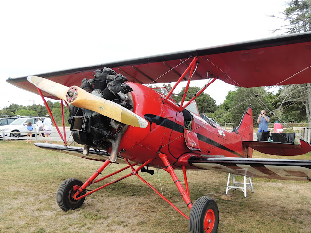
About 2:30 PM at the XXX a bus station the "bus master" pointed out a red biplane overhead and told us we could both take a 30 minute ride for $150! I had just received some birthday money from my favorite mother-in-law and decided this was how I wanted to spend it. We quickly found a phone number to make a reservation and headed to the air field via the #10 and #8 bus.

This is our plane - a 1940 WACO trainer - build in Cleveland!

Red Baron and Snoopy strapped in the front seat

This strip of sand joins the main island to Chappaquiddick Island

This is the "infamous" bridge

Tide Hiker is down there somewhere.

Another view of the anchorage and the town


Wednesday, September 2, 2015

Penzance Bay (Near Woods Hole) anchorage

Wednesday September 2, 2015
41 31 912 N
70 40 633 W

Another nice day - at least on the north side of the Cape. Today we were planning to transit the Cape Cod Canal into Buzzards Bay and then find an anchorage in the vicinity of Wood's Hole. Cavara was also making their way to the canal, timed to transit in our company, but we expected to part ways on the other side.

The CCC is the largest sea level ship canal in the world - no locks etc - but the result of that was some pretty strong currents. Because of the strong tidal current thru the canal we needed to time our arrival for the "slack before the ebb" at the north end.

The 24 NM run across Cape Cod bay was achieved right on schedule and we entered the canal right at slack with no current. It picked up strongly as we headed south and by the time we reached the only impediment - a lifting railway bridge we were seeing 3 or 4 knots of current. According to the guide "the railway bridge is seldom in the closed position" but as we approached at "light speed" down it came! As we rapidly approached we did notice an Army Corp of Engineers patrol boat flashing its lights and broadcasting a warning on the radio.

Whoa! The railway bridge is down!


There were several pleasure craft of various sizes in the canal. Doing a "U turn" in a 49' boat in a 4 knot current in a 300' wide canal is not that simple, especially if the other boats do not "dance" well with us. We immediately broadcast our intentions to create an anti-clockwise race track pattern and fortunately all the boats fell into step. After only one loop the bridge reopened.

The wind on the north side was a pleasant 5 to 10 kts. On the south side it was blowing at least 20 kts, and created a "wind against tide" situation, resulting in 4' to 6' "square waves" as we entered Buzzards bay, right on our bow. The next 10 miles in these conditions proved to be very rough, with Tide Hiker making lots of spray.

The anchorage we targeted had anticipated these conditions and got us entirely out of the fetch and most of the wind. We anchored in 15' with a solid sandy bottom. Out of the wind and waves it was a very pleasant spot. I barbecued chicken and veges for dinner. We picked up about 30 TV stations but there was nothing worth watching.


Tuesday, September 1, 2015

Provincetown

Tuesday September 1, 2015
42 02 782 N
70 10 989 W

This place is a hoot!
For those that are not aware, Provincetown is essentially a gay vacation community. Lots of guy couples holding hands and very interesting leather shops. Don't ask me how I know. Sorry that the following photos are from the rear, but I just did not have the gonads to take them from in front. (That "guy" with the bra on looks pretty tough!)

I would not wear boots with those shorts!
What's with the boots? Its summer!

We dropped the mooring ball at about 7:45 AM. Nick came with us for the ride. Our timing was all wrong - the flood tide was very strong and held back our speed  - or that's what I thought. After a couple of hours at 5 knots I realized that the port engine was not in gear - I was running the boat from the flying bridge and the port engine control had not engaged the transmission. Something new to think about.

Once we were running two props our speed reverted to 7 plus knots and we started making good progress. It was a perfect day - about 80 degrees, sunny and a mild breeze. To add to a nice day we saw a couple of "big" whales including a full tail show! We arrived right on schedule at 3 PM and took a mooring ball.

Our plan was to head into town and "take in the sights" for an hour or two, enjoy an early dinner and put Nick on the 7:30 PM fast ferry back to Boston. However Deidre's knee was acting up and she decided to take a break, so Nick and I headed in "alone". Now Provincetown is a very gay community and Nick and I make a fine couple, so I am sure we turned a few heads! We stopped for a beer and a couple of shots and met a very nice couple - just married and on their honeymoon - turned out the groom (huh?) was an IRS agent, so we were extra friendly.


The history books say that Provincetown is where the mayflower settles first set foot in the USA. There is a very impressive monument to that effect. I imaging the Pilgrims would be a bit uncomfortable arriving there today.