Sunday, April 29, 2012

Isle of Palms 32 48.330N 79 45.574W


It was dead calm all night and we both had a great nights sleep. The only disappointment of the morning was that sometime during the night the inverter tripped out (so the frig stopped running) with the batteries still at 63%, suggesting once again that we will be investing in new house batteries when in Charleston. We "solved" the problem by starting a generator, and then we were on our way by about 10AM.

Elliot Cut
 The Isle of Palms is a few miles north of Charleston harbor, but all up we only had about 25 miles to travel for the day. We were pretty familiar with the area, having boated hereabouts when we lived on the IOP. It was a pretty straight forward run, the only interesting bit being Elliot Cut on Wappoo Creek where the tidal current can get up to 5 or 6 knots if you don't time it right. We arrived an hour or so before high tide and the current was only a knot or two against us, so it was no issue.
Charleston skyline from the west

Once through Elliot Cut we started to see the skyline of the city and the familiar land marks. The new cable stayed bridge looks fantastic, plus there was a cruise ship in town.

Crossing the harbor took about 1/2 an hour and then we were back on the ICW. First landmark was Tolers Cove where we used to keep the Rybovich. Then Gold Bug Island where the rehearsal dinner for Kylie and Ryan's wedding was held. The IOP Marina was only a few miles further.

Tolers Cove Marina

We have rented a private slip in Morgan Creek on the IOP for the month, but we were 2 days early. I thought the slip was unoccupied and so arriving early would not be an issue, but Kylie checked and there was still a yacht in the slip. So we reluctantly decided to rent a transit slip for Sunday night, anchor out Monday night and claim our slip Tuesday.

We docked at the Marina and enjoyed our reunion with the kids and Oliver their dog. We did the boat tour and enjoyed some beers before going ashore and catching up with old friends on the street. Then back to the boat for barbecue dinner with the kids. We were docked right next to the IOP City launching ramp, and it was a nice warm Sunday, so we were treated with a stream of boats and sunburned humanity all afternoon and into the evening.

Cooking the burgers

Looking west into Morgan Creek from the marina.

Saturday, April 28, 2012

Too Goo Doo Creek 32 40.204N 80 17.476W

Let's not do that again.

It all worked out OK in the end, but being on the bulkhead was a hassle. The wall was rather rough, the tide was about 6' (so we needed to monitor the fenders all night), and we were right where the "action" was so there were people wandering about all night. Also, it was hard for Deidre to get on and off the boat, and so when we were invited for dinner we declined. But Deidre and I managed to get off the boat this morning and walk into town for breakfast. And that was good. I did not get a great nights sleep - I seemed to be up and prowling with the flashlight every hour or so.

Travelling Companion
Its a new day (Saturday April 28)

We were under way by 10AM and the conditions were perfect. The water was like glass. We were only about 50 miles (as the crow flies) from Charleston, and we had decided to make it two easy days. Coincidentally there were a bunch of trawlers in Beaufort that night, and so we had plenty of company on the water, and there was lots of radio chatter. Most were bound for Charleston, so we bid farewell over the radio as we veered off into this creek.

This seems to be a great anchorage - nice and wide, protected from a very mild south wind and a sandy bottom to anchor in. We are getting better at anchoring and the whole thing went off well. So we have a relaxing afternoon planned.

Entering Too Goo Doo Creek
Tomorrow we will reach Charleston. It will be fun to approach the IOP from the water. Kylie called us this afternoon with the news that there is a boat in "our dock" and so maybe we will not be able to take possession on Sunday (the 29th) as planned. I have emailed the owner - lets see what he says.

Friday, April 27, 2012

Beaufort, SC 32 25.800N 80 40.346 W

Up against the wall!

This morning about 6AM I was sure I felt some one on the boat. I grabbed my flashlight ("torch") and headed upstairs to the deck. Nothing seemed amiss as I peeked out into the aft deck, and that's when I saw it. The newspaper had been delivered! Such a cool place.

We reluctantly pulled out of Harbor Town about Noon. We had spent the morning over a pot of coffee and the paper. Later in the morning I had washed down the hull with "free water" and cleaned windows and filled the water tank. Deidre did 4 loads of wash, made the bed and vacuumed the Salon, Galley and RPH. It was a relaxing and productive morning.

We headed out about Noon. We were planning a short run - about 4 hours to Beaufort, SC. We had boated to Beaufort before in the Bayliner, from Charleston, and had fun memories. It was a beautiful day - AT LAST - blue sky, a 5-10 kt breeze, lots or porpoises and even a manta ray.

The bulkhead - Beaufort, SC
Beaufort has a marina ($1.75 per foot) and a bulkhead ($0.50 per foot) and some places to anchor out. We chose the bulkhead, it looked OK.

There were some people wandering along as we approached and Deidre yelled out "catch this" and tossed them a line, with the specific instruction: "Tie it to something!"

View from the aft deck
That was a couple of hours ago when the tide was about 50%. Now its about 90% and I feel we are in an elevator with windows. All we can see is dead mussel shells! We were invited by a bunch of trawler people to join them for dinner, but had to admit that we could not get off the boat!

(Actually its not so bad. Deidre is making a Boboli Pizza in the Microwave Convection oven, and those are good.)

We do want to go out for breakfast, as we have great memories of breakfast with Sue and Bruce at a local "greasy spoon" and we want to relive the experience. So I have been experimenting with different approaches for Deidre to get off the boat in the AM when the tide will be a bit higher.

We managed to get to breakfast. Tide Hiker managed to make an appearance as the tide rolled in. (Who is the short, fat old guy in the photo?)


Thursday, April 26, 2012

Harbor Town, Hilton Head.32 08.281 N, 80 48.649 W

Bliss (and Internet Access!)

Hilton Head
We have decided that this is really the perfect marina.  It's a resort marina on a resort island, run by Hilton. It ain't cheap, but we deserve it, and we are out of the wind! Plus, we arrived really early so we get our full 24 hours. One example of why its worth it - they sent an attendant into the channel in a "tinny" to lead us in. He jumped onto our dock ahead of us, took the lines from Deidre, tied us up and presented us with a bottle of red wine. Not bad.

We came here with our friends the Clements in the Bayliner maybe a dozen years ago and we have great memories of that trip and our stay here. There are a dozen restaurants (we have a 10% coupon too!) and we are planning to eat out tonight. And maybe breakfast tomorrow! Since we are hooked up for electricity and water, Deidre is doing a few loads of wash and I have given the front of the boat a bath. There is strong WiFi so I can catch up on the blog. We have returned from the wilderness!

Coastal Cruise Ships.

We have noticed these "mini" cruise ships in several ports now, and also have come across one on the ICW. This one is "parked" at Hilton Head. If it is still here when we leave tomorrow I will get a closer photo. There was also one at Fernandina Beach. They seem to have about 3 rows of 6 cabins on either side and carry silver haired people that are happy to wave at us.

We are now only about 60 miles (as the crow flies) from Charleston. We plan to do it in 3 days, stopping for a night in Beaufort, the next night at anchor,  and arrive at the IOP on Sunday. Ky has the day off, so plans to meet us. We will then have a long week before Deidre heads to Australia.


Wright River 32 03.045 N, 80 58.473 W

Big Marsh Flies

I like to pilot the boat from the Flying Bridge. I can see the world better from up there, and its just "more outside". Deidre is not so keen because its high, and when the boat pitches around she feels a bit insecure. But today was special, because we were attacked by marsh flies, AKA horse flies. There were a lot of them and they bite you if you lower your guard, so both of us retreated inside.

Just about all the Georgia coast line is marsh, and it extends deep into the interior. There are pockets of "civilization", but not much. If you are in the right mood, then it can be beautiful and intriguing. If you are fighting off big biting flies, then maybe not so much. There are few signs of civilization and very few lights at night.

Anchored in a tidal creek for the night

Deidre is Amazing.

Last night we had sweet and sour chicken for dinner. Monday night we had pork loin with roasted potatoes.  When navigation gets awkward, Deidre sits behind me in the RPH and calls the course corrections. When we anchor the boat she runs the boat from the flying bridge while I mess with the anchor and chain. When we dock she handles the lines and calls instructions to me. When we go to bed she says “Don’t worry about the wind, we are fine”.  What a woman!

A bit of traffic.

We saw a bit of traffic today, and a couple of bridges. We needed to overtake this barge - easier said than done because he was running about 7 kts and we were running at about 8 kts, so the whole process seemed to take hours. I talked to the driver on the radio, and he was pleasant enough, but we were not his concern. As we drew alongside, we were intrigued by the items on the barge, so radioed the tug and asked the captain what they were. He responded "No clue, something for the defense department". (Maybe I should not publish this photo!)


Today we ran for only 5.6 engine hours (Take almost an hour from that for dropping and recovering the anchor) and made it to St. Augustine creek by about 4 PM. We are still being dogged by wind. It is really starting to piss me off.  It does not bother me much when we are underway, but finding a decent protected anchorage with enough depth difficult. Today we are in a creek that is barely wide enough plus it is used by local boat traffic and they seem upset that we have parked our ample beam in “their” channel. The positive side is that we are becoming a better team at anchoring, and Deidre is really picking up how to handle the boat controls.

I had a snooze on the couch after dropping the anchor and so we did not sit for dinner in the RPH until about 7PM. As we ate, I was sure I could see the bank "sliding past" - this observation was quickly verified by the GPS. The bloody wind and the tide flow was teaming up on our anchor and it was losing. The dinner table was quickly abandoned as we jumped to the "get the engines running and the anchor in before we are blown aground" mode. As we got the anchor up we then became aware (across the marsh) of this "big old bloody ship" heading our way. No mind we were in a "named anchorage" (whatever that means) and here was this 200' long rusty ship heading our way, filling the whole creek. Fortunately we were underway and could maneuver, so I hailed "it" on the radio to make a passing plan - no answer - and I hailed 4 times with the same result. So we just headed for the bank and got out of the way. As it went by it became apparent that it was some sort of offshore "Casino" cruiser. 

That was it for us. Big tide, lots of wind, bad holding and traffic. We decided to move, late or not. Deidre had picked out another potential anchorage about 5 miles away but on the other side of the Savannah River, so we headed for that. We crossed the Savannah river in the dusk, it seemed a complicated route, and we did not run into any container ships. It was dark when we finally made it to the Wright River and we dropped anchor in the dark and it "took" first try. All a bit nerve wracking, but it was a better spot so we were set for the night. Happy ending.


Tuesday, April 24, 2012

Kilkenny Creek 34 46.710N 81 11.018W

I am so fed up with this bloody wind! We just do not seem to get away from it. It is really starting to get under my skin. It is not so bad when we are moving, but finding a protected anchorage and making sure that the anchor does not drag becomes a chore!

We made it to an anchorage in Kilkenny Creek today. Apart from the wind, it was a pleasant enough ride.

Each afternoon we find ourselves scouring the charts for an anchorage that is deep enough ( 10' to 20' is good) that is wide enough (we put out at least about 100' feet of chain so we need 200' of swing room - assuming the bottom is level  and it usually is not) that has good holding bottom (we like sand and have become wary of soft mud) AND that gives us some protection from the bloody wind. But a problem is that there are no (or few) trees, so even though we may be tucked in behind an "island", the "island" may be only 2' above the water and so offers little protection. Oh well, its good to some times remember we are doing this for fun!

This location had some extra appeal in that another mile or so up the creek there was a 'fishing camp" style marina that we could run to in a pinch. Was not needed, but it was there.


Monday, April 23, 2012

Darien, GA 31 22.040 N, 81 26.112 W

Darien, GA Monday April 23

We departed Umbrella Creek this morning after two nights at anchor. It blew like a SOB just about all day Sunday and Sunday night. Our anchor was holding OK, but I was a bit spooked by the strength of the gusts that when it was time for bed I sat up in the Pilot House with a couple of pillows and the iPad. It was so black out that I could not see the shore, but the iPad showed our location down to a couple of feet so after every howling gust I had a look to be sure we had not dragged. During the afternoon Deidre and I had gone up on the Flying Bridge and removed all the plastic to reduce our "sail". I should have had more faith, Tide Hiker held her ground. By about 2 AM the wind seemed to die down so I went to sleep. I woke up at about 4AM and all was calm, so I went below to bed.

The forecast for today was not much better, but we just wanted to get moving. It seems easier to move that to park, so we recovered the anchor and were on our way by 9AM. We had a lot of chain out - maybe 150' in 15' of water, and the tide and wind were still rolling, so the recovery took some time, with me on the bow and Deidre at the controls. She is getting quite deft at moving the boat towards the anchor, and we got it up without blowing the breaker.

It was good to get underway. It was sunny but so windy and cold (the storm had reduced the night time temp to high 40's and when we got underway it was only 52 degrees) that I decided to run the boat from the Pilot House - the first time ever. We got away early because the tide would peak about 10:30 AM and we had a couple of "trouble spots" to get over with the extra water.

The Georgia part of the ICW is a bit tricky. There are only a few towns and the ICW winds thru the marsh and tidal rivers. I steer the boat following the day markers and the chart plotter, and at the tricky spots Deidre sits behind me with the iPad, calling instructions. As I have mentioned previously, Tide Hiker is a bit windy, and seems to be tipped 10 degrees depending upon where the wind is coming from. It bothers me.

After the last couple of nights we did not feel like anchoring out again. There is virtually no civilization around here, but Deidre found the historic town of Darien mentioned in a few of the cruising books. It is an old town, about 10 miles inland up the winding Darien River. They have a municipal dock, so we turned off the ICW at Day Marker Green 183 and headed inland.

Tide Hiker in Darien
It took about 10 calls to get anybody to answer the phone. But eventually someone did, and yes, we could park the boat at the city dock but there would be no one there to take our lines. That makes it hard for  us - the wind is still blowing, the tide is racing, and Deidre does not do well jumping from a moving boat to dock. But as luck would have it there were a couple of "locals" crabbing off the dock, and they helped us - ever so slowly, but it got accomplished.

These days Darien is a bit of a back water, but the town has an interesting history. It was settled by Scottish Highlanders in the early 1700's and a fort was built to defend against the Spanish in Florida. The Spanish were the losers at the battle of Bloody Marsh in 1742 but the British burned the place down during the revolution. There was obviously a lot of money in cotton and timber that the town was rebuilt, only to be burned down by Sherman in the civil war. Which just goes to show how crazy the human race has become.

Safe arrival snooze
Tonight we will eat at "Skipper's Fish Camp". As you can see from the previous photo, we are right next to the shrimp fleet, so the sea  food should be OK.

There is only one small complication. I just put a blanket on the Admiral, and she is out like a light.


Saturday, April 21, 2012

Umbrella Creek 31 00.934 N 81 27.720 W

We tried to leave Fernandino yesterday but had a problem with recovering the dinghy. Like a lot of things related to living on board, lifting and stowing the dinghy is "a bit of a project". Methinks the dinghy is a bit big for the crane, so the lifting and stowing involves a bit of sweat and effort. (When we get to Charleston, I think I will take the davit to an engineering shop and add about a foot to the end of the arm.)

To make a long story short, we attempted to recover the dinghy before departing on Friday, but the hoist on the davit gave up with the job only 90% done. So after an hour or so of messing about, I called the marina and asked if we could "borrow" a dock for an hour or so, so that I could round up a bunch of the MTOA people and get the problem solved.

They answered in the affirmative, but assigned us a dock way in the deep recesses of the marina. We "wended" our way in and found the dock and some boaters took our lines. But from that moment I was thinking about how we would get out without wiping out some boats and docks along the way.

Sunset 
A few minutes later we had 4 "consultants" on board and after an hour or so the problem was solved. (The integrated GFI was wet - we cut it out!). By then it was Noon and it seemed late to start (we had missed the tide, and I was worried about my exit) so we took the dock for the night. Deidre made a pork loin roast for dinner, we had the AC on all night - luxury!

Slack water was at about 9:30 AM so that was our ETD for Saturday. But Deidre needed supplies and was offered a ride to the market, so she set off early while I prepared - mentally and physically - for our departure. I had a chin scratching meeting with a couple of other captains (I like the sound of that word - in general boat people call me "Cap") and we had a plan.

Deidre was back by 9AM and I tried to start the engines. I say "tried" because the starboard engine did not respond from the bridge. I visited the engine room and started it from there. I was not going to postpone another departure, especially since I had sucked up all my courage for our departure maneuverings. Have to sort that problem out later.

Our boat is 49' long and weighs 30 tons and the "bridge" is 16' off the water - certainly not a "tinny" by any means. To get out, I had to drive the boat sideways off the dock for about 10 feet, back it down half a boat length, execute a 120 degree turn in reverse, move a boat length forward and do a 70 degree turn left in another boat length. Half the "boat people" had come out to watch. There was lots of clapping and cheering as we missed everything and everybody, and headed out the fairway. On our way at last.

RED 32 - In the Atlantic!
Today's 4 hour run was uneventful. It was a clear morning with not much wind. The only excitement was "heading out into the Atlantic" to make the turn at "RED 32" in the mouth of one of the large Georgia sounds. There was a bit of a swell, but not much else.

The intra-coastal in Georgia is not well maintained. There are currently 4 alerts for shoaling that we can only avoid at high tide. Plus we expect a storm tonight with lots of rain, so we have holed out in Umbrella Creek for the rest of the day. It is well protected and the right depth, and we can make departure tomorrow that is co-ordinated with the tide. We are getting better at anchoring, and we did a good job this afternoon, except that I forgot a basic step (loosening the capstan) that could have caused a problem in more difficult circumstances. Maybe next time!

Umbrella Creek (and my new WiFi aerial)
Umbrella Creek is very isolated. Apparently this is typical Georgia coast line - quite different than Florida. Basically all marsh, tidal creeks and rivers. Florida's coastline is heavily developed - Georgia's not at all.

We will be in Charleston in a few days. So I have rented a dock in the IOP area for a month, starting May 1. Deidre is flying "home" for 16 days to visit her Mum and Dad. I will spend the time working on the boat and visiting Ky and Ryan. What's the hurry?


Thursday, April 19, 2012

M.T.O.A. Rendezvous

Thursday Evening

We have just made it back to Tide Hiker after the Awards Dinner, the last event of the rendezvous. Tomorrow we plan to get underway and head north, probably to a marina in St. Mary's, which will put us in Georgia. We may decide to buy fuel at the commercial dock before we leave, as we hear it is only about $3.75 a gallon. St Mary's is only a few miles away, but we feel the need to get into a dock where we can charge the batteries 100% and give the boat a good wash, and take a break ourselves.

The MTOA Rendezvous has been really great. We have met a lot of new people and learned a bit more about boating. Today was a busy day, and a good example -

9:00 AM: "How to pick up a mooring ball"
10:30 AM: "Provisioning for the Bahamas"
1:30 PM: "Using distress flares"
3:00 PM: "Great Loop I"
4: 30 PM: "Great Loop II"
5:30 PM: New members photo
7:00 PM: Awards dinner.

The dinner was in a tent on the water front. It was a paper plate and plastic cutlery sort of dinner, but filled us up. After a while the "no-see-ums" arrived and we all beat a path home. Its almost 9PM now, so we will stay up till the batteries are charged and then hit the sack


Sunday, April 15, 2012

Fernandina Beach 30 40.201 N 81 28.216 W


Saturday
We decided to stay another day in St. Augustine because the weather forecast was not good. (See! We are learning!) But we had recovered the dinghy the night before and it was just too windy to relaunch. Fortunately the marina offered a water taxi and so we called for a taxi and took a ride into the shore.

There was a bike race underway when we made it down town. We watched a couple of laps and moved on to the Post Office and then walked a couple of miles to a supermarket, and caught a cab back to the marina. By the time we were back on the boat it was really blowing and so we settled down for a quiet afternoon. We had dinner plans with new friends in the marina, but we had to cancel out because the water taxi ended at 6PM and it was still blowing.

That afternoon we ran out of water! The tanks on the boat have sight gauges, and you have to open and close the valves top and bottom to get a reading. (Honestly, this boat has more valves then the MMBW) Well, after the first few readings I forgot that part, and was consistently amazed at how little water we were using! So that put a damper on things - no washing and no coffee. (Deidre used ice tea to add moisture to dinner that night.)

On the bright side, our water lasted 10 days, including two showers a day, one fresh water toilet (the other is salt, thank goodness)  and a couple of loads of washing. I think the tank is 350 gallons, so all up 35 gallons a day. We have always planned making one marina visit a week, so that will work out fine.

Sunday


Bob Voyage
We needed the water so we went straight to the fuel dock in the morning. I loaded 200 gallons of diesel while Deidre loaded the water. (It would be rude just to go in and take water.) The fuel was $4.29 a gallon, so the total was about $860. The boat will hold 800 gallons of diesel, and we now have about 500 total gallons on board. Our travelling companion for the day was "Bon Voyage" owned by Bonnie and Jon. They are really fun people from Aimes, Iowa. Bon Voyage is a newish 44' Krogan, a classy boat. (Trawlers have a definite pecking order, and Krogans are at or near the top).

We had planned making the trip to Fernandina in two days, but Bonnie and Jon wanted to do it in one, so we changed our reservation and made the distance by about 6PM. It was a very pleasant run, no miss-steps, and Tide Hiker ran very well. The weather started out a bit blowy, but settled down as the day progressed. Part of the trip was through the suburbs of Jacksonville Beach, and we saw a lot of amazing houses.


After settling onto a mooring ball at Fernandina Beach, we launched the dinghy, picked up Bonnie and Jon and went into town for dinner. By the time we dinghy-ed home the water was like glass. Despite the background noise from the paper mill, we slept like logs.

This morning we plan to take it easy, cleaning up the boat in anticipation of visitors. I also need to re-visit the forward bilge (where we had the nasty spill a few weeks back) and do a follow up clean. After lunch we will dinghy ashore to "register" for the rendezvous.

Friday Morning.
This is not quite the image of the quaint port of Fernandina that we had expected! There is a huge paper mill, just south of the marina and down town. This photo was taken from the bow of our boat, moored in the harbor.

We know from experience that paper mills can really stink, plus it generates noise 24 hours a day. Such a shame, as the rest of the place looks great, We went ashore last night for dinner, and the old town is indeed quaint and appealing. We are here for the MTOA rendezvous, staying 5 nights.


Friday, April 13, 2012

St Augustine 29 53.285 N 81 18.352 W

The party last night was very pleasant and very retired-ish. Meaning it started promptly at 5:30 PM and we were all safely home by about 8:00 PM. And I think it is safe for me to say that Deidre and I were probably the youngest couple there. One of the captains I met was 94!  But it was fun, we met some new cruisers and we were introduced to the organization. And the food was great!

As previously explained, we now have a mail forwarding service, and we had arranged for the next batch of mail to be forwarded to the host. So we received a large box of mail that afternoon and had a lot of bills to pay, plus a couple of tax returns to sign and mail. Plus we received our new MTOA burgie and it is now proudly flying on our bow.

The tide maxed out at 7:00 AM and the place was a bit shallow for us, so we were up and away by about 7:45 AM and since the run to St. Augustine was only about 20 miles we had arrived by late morning. We had reserved a mooring ball at the City Marina, and we were successfully attached with engines shut down (and batteries 100% SOC) by 11:00AM.

St. Augustine dinghy dock
We had followed an MTOA boat all the way and they called us on the radio after they had moored, and invited us to meet them at the dinghy dock and walk into town for lunch. We launched the dinghy, used it to put an extra line on the mooring, and met them at the dock. Lunch was pleasant, then we spent an hour or so wandering the old town.


Yikes, pirates!
St Augustine was first settled by the Spanish in 1565 is "the oldest continuously occupied settlement" in the USA. The Spanish and the British squabbled over it for the next few hundred years. Sir Francis Drake burned it to the ground in 1586. The castillo was started in 1672 and has made an appearance in many pirate movies. The town is charming but quite touristy, and I am sure that many "400 year old" buildings have been added in the last few decades.

We have booked a berth at the marina for tomorrow. Deidre needs to do some shopping and the boat needs a good clean up, so it will be a busy day. Plus we have some friends arriving Saturday afternoon, and we all planning to be ashore for dinner. Sunday morning we head for the Jacksonville area.


Thursday, April 12, 2012

Palm Coast 29 35.455 N 81 12.179 W

We spent a very comfortable night, it was dead calm, the boat did not seem to move a foot. We were up at 7 AM and on our way by 8 AM. It was sunny and calm, but the forecast called for increasing NE winds, and they arrived by mid morning. Because the wind was coming from the North, and we were heading North at 8 kts, up on the bridge it felt pretty strong.

We were headed for Palm Shores, about 35 miles North. Palm Shores is a large housing area on a canal system, so that all the house have waterfront and most seem to have docks. Apparently there are about 20 trawlers based here, and they are hosting a party for people like us headed North for the rendezvous. The party is tonight. You can see a representation of the canal system on the chart plotter in this photo.

We had been told that if we called ahead and arrived early the organizers would have a dock for us, and that's how it worked out. The depth was marginal for us, and we certainly churned up some mud, but we are now safely docked behind Bill Golden's house. They invited us to "plug in" to their 30 AMP service on the dock, and we have done so, so now our batteries are happily charging. ("Happy batteries, happy boat"). I also attached one of our hoses to their garden tap, and gave the decks a bit of a clean up. I would have washed down the whole boat, but Deidre thought that was "taking advantage".

New friends: Bill and Laura Benson popped in before the party. Bill & Laura happened to be visiting "Bobby" the MTOA Port Captain when we were "in distress" a few nights ago and so knew the whole story. Bill went below with me to check on the fan belt replacement He also offered to help me re-set the main engine tappets next time we crossed paths. Nice guy!

Short note on sunken boats.

We have now seen three sunk boats - all sail boats. I assume there may be more, its just that these did not sink "all the way". We saw one at the anchorage at "Peck's Lake" on our first venture out, another in the Vero Beach mooring area, and another today a little north of where we anchored for the night.

Apparently abandoned boats, on the bottom or not, are a bit of a problem in Florida. If one abandons a car, the tires go flat and after a month or so the city tows it to a junk yard and its gone. But abandoned boats eventually sink, pollute the area with their oil and whatever, and are expensive to remove, and have zero value. At the moment, many local governments do not have the $$ to remove them. This boat (on the left) was just off the main channel and looked like it had been stripped (no wheel, no winches. no rigging etc)


Wednesday, April 11, 2012

North Daytona Beach 29 14.058 N 81 01.397 W

Short day today. We have been "invited" to a party in a location called "Palm Shores" which is about 40 miles from our anchorage last night and 30 miles from our new location today. The problem is that there appear to be no decent anchorages between here and there. So we had a lazy start this morning and did the 10 or so miles by lunch. We are anchored in the North Datona Beach area at the above Latitude and Longitude and we will make an early start in the AM.

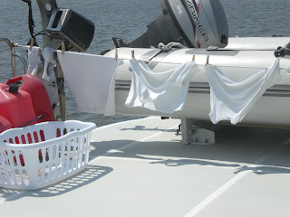
But the time is not being wasted! Deidre did the "whites" washing this morning and it was out to dry on the "Boat Deck" when we got under way. The washer and dryer are in the engine room, which is a bit hard on Deidre, but she seems to be getting the hang of it.

Now we are anchored, it will be a quiet day of emails, computer, books and TV, and just maybe some eating.


Pelican Island
Stupid Anchor

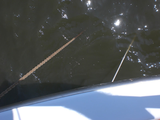
This is another example of "Stupid Anchor". The bow of the boat is on the left of the photo. The chain is the anchor chain, the rope is the "snubber" which is connected to a ring near the waterline at the bow. (It serves to lower the point of connection to the boat, thereby improving the scope by a factor of about 2 in shallow water - AKA Florida)

I would expect the boat to point into the wind or the current, or the average of them both. But not Tide Hiker, she points where she feels like it just to confuse me. All the nice yachts are lined up like cows in a paddock, but Tide Hiker is "looking the other way".


Nice Fishing Boat


Tuesday, April 10, 2012

Near New Smyna


Easy run North today. Went thru a couple of nice "Cuts" and past a few small holiday towns. We were through New Smyrna soon after lunch looking for an anchorage. We decided upon "Rock House Creek" and dropped anchor by about 3PM. That's when the fun began - again.

The Mystery of Anchoring

The anchorage is a small inlet between two of the many "islets". It is nice and deep, especially on the south side, and protected from the wind thru about 270 degrees, but with a sandbank on the east end. We turned into the opening, targeted the "middle", turned into the wind and dropped the anchor, sort of where we intended.

The boat settled into the most awkward pose. Like we were aground, or the anchor chain was caught on a rudder or propeller shaft, which seemed unlikely. It just made no sense. The breeze was light and was "east-ish" and there was a current that was probably "west-ish", but the boat just did not seem to know "what to do". The anchor rode was off in the most unlikely direction and the boat was pointing "nowhere".

But we are learning. "If it does not seem right, MOVE." So we picked another spot about 1/4 mile back east, and went thru the hassle of recovering the anchor. This time we paid more heed of the current (the tide was obviously going out thru this inlet) and the boat behaved like it knew what to do. The result is that we are totally "settled" and very comfortable. Here are a couple of photos, one east towards the entrance, one west towards the ICW

Looking west
Looking East
 

Monday, April 9, 2012

Titusville, FL

Simple lunch in Cockpit
We enjoyed a nice 5 hour run from the Banana River to Titusville on Easter Sunday. The weather was calm, both engines ran normally and there was very few people on the water. We made good time and arrived before 2 PM and put Tide Hiker on a ball outside the Titusville City Marina. After a quick lunch we put the dinghy in the water and headed in to check out the marina and the town.

The marina was "full" of manatees. We have seen manatees before, but not as many as this - maybe a dozen or more grazing in the marina. We had to be careful not to run into one because the props give them terrible injuries and scars.

We tied up at the dinghy dock and headed into town. It is a bit of a sad town, especially since NASA has shut down the shuttle program, which cost about 10,000 jobs. Did a light shop at not-quite-supermarket, bought an ice cream and headed back to the boat. Deidre grabbed a book and settled down in the cockpit, I did the same, read a few pages and promptly stretched out on the pilot house bunk and enjoyed a 2 hour snooze. Its a tough life, but some one has to do it!

Last night we grilled salmon on the bar-b-que and Deidre made a great salad. After dinner we decided upon a movie - a remake of Colditz - the Germans sure must be fed up with WW II movies by now. It was presented in two Parts - so we headed for bed after Part I, and will watch the second half another day.


Side note on the mysteries of  electricity.

One of the challenges of the boat for me is the electricity supply. The engines generate 12V power when we are under way. We can also get 110V from a dock (if we are in a marina) or generate it ourselves on one of two generators.  (The generators actually make 220V electricity, but it is split into two 110V "legs" which the operator (me) is meant to keep reasonably "balanced"). We also have a 940 AH 12V battery bank, that will run 12V applications and provide power for a 110V inverter, so we can run "light duty" 110V appliances on just battery power. The distribution of this 110V and 12V electricity is managed thru a two breaker panels, and there are a couple of devices that help you monitor and measure!

Needless to say I am a bit "out of my depth" with this science and so we have had our struggles. One such challenge is to make it thru the night on our 940 AH battery bank. There are also all sorts of rules relating to batteries, such as:

1. Do not run the battery bank down under 50% "state of Charge" (SOC) - very bad for them, apparently
2. Do not try and use a generator to charge them any more than 85% - 90% - the last 10% - 15% "soaking" charge is very slow and inefficient.

So in effect we really only have about 35% or about 350 AH of battery power to last us thru the night. If we use at the rate of 35AH, we can run on batteries for about 10 hours, but the problem has been that we are not lasting that long and alarms start going off at 4AM.

One issue is that we have a full sized domestic frig with a whopping freezer, and it runs on inverted power and seems to be sucking up our battery power. At the moment we only have 2 people on board - imagine how our situation will deteriorate when we have 4 or 6! I want to be able to live on the boat like living in a house, not walking around at night with a flash light because I do not wan to turn on any lights!So I plan to get some serious advice at the MTOA rendezvous later this week.

This afternoon is dead calm, not a cloud in the sky, but enough breeze to keep us comfortable. We have all our screens down on the west side of the boat, giving us plenty of shade. Deidre is in the RPH with a book.

There is not much traffic on the ICW, but this classy old boat just passed us to get fuel in the marina.

Tonight we plan to take the dinghy to a water front restaurant and have "a night out". Tomorrow we are heading north again, and hope to get to the Datona or Smyma Beach area.


Friday, April 6, 2012

North from Vero Beach

April 6, 2012

If I had looked at the weather forecast, and had shown some good judgement (that's asking a lot) we probably would have stayed where we were in Vero Beach! But you know me, "Mr.Let's-Get-On-The Road", and now we are stuck on this lousy anchorage a few miles south of Melbourne.

Nice house - Aussie flag
Half an hour after leaving Vero the wind got really strong, quiet unpleasant. There was basically no one else on the ICW, and I started to worry about where we would spend the night. So at about 2 PM we spotted an anchorage that (according to the chart) offered some shelter from the wind, and here we are. I think I will spend the night on "anchor watch" as I am a bit worried about our exposure. We could move, but I am not sure we can better our present set up. I plan to review our situation at high tide, about 8 PM

It got worse. The wind picked up and turned NW, which was not good for us, as we picked the anchorage for NE wind.. And it got stronger, and I got worried. I can only guess, but it must have been blowing 30 to 40 kts. So hard that it was tipping Tide Hiker "over" several degrees, and we decided to leave.

Upping Tide Hiker's anchor has proven to be difficult, and in a HOWLING GALE is is even  more so. The problem is that the windlass tends to stall if there is any load on it other than the weight of the chain, and throws the breaker. The breaker is in the chain locker, a long way from where I drive the boat.The breaker popped 3 bloody times and I had to race down and up 24 stairs to re-engage it. But we got the anchor up and were on our way.


I must admit, Tide Hiker is a bit of a windy boat. The Fly Bridge has a "hard top" that is 19 plus feet above the water, and it is totally enclosed by Eisen-glass, its like a big sail! (My friend Tony Peach pointed this out to me before I bought the boat). So in all this wind, it was leaning over, which I felt quite disturbing. And it was getting dark. And I really did not know what to do.

As mentioned before, we have joined a group called the MTOA (Marine Trawler Owners Association) and they have representatives in most ports, so Deidre suggested we call the Melbourne number. The lady who answered the phone - "Bobbi - was great. She suggested a perfect anchoring spot and told us how to get there. The only problem - at least then - was that we would arrive in the dark. Mind you, we are getting the hang of the chart plotter, radar etc and so now we had a target.

Just when I was starting to breath again - engine alarms started going off - the Starboard engine had over heated and I shut it down. Great! let me see:
     1. Blowing a gale
     2. Pitch bloody black
     3. Just one engine.

Fortunately the wind was on our starboard quarter, and that was the side of the engine that had quit. So we seemed to be able to go straight - sort of. I handed the wheel to Deidre "Aim for that light" and headed for the Engine Room. To my great surprise, the Starboard engine still seemed to be running, and I headed for the emergency shut down! Not so fast - just Tide Hikers forward motion thru the water was spinning the shaft, the motor was not running.

Looking for the cause of the overheating, I closed the engine thru-hull and opened the strainer - no problem, clean as a whistle. Next step is the impeller (and last step for me, as that is where I run out of ideas) But it was too bouncy, and the impeller on the stb engine is on the awkward side, and I needed to be up with Deidre. Sort that out tomorrow.

I called the previous owner for advice. Not much they could do, but consensus was to notify the Coast Guard. So I got on the VHF and had a nice chat with a lovely lady who took our description and advised us to report in every 15 minutes and "put on our life jackets" (which seemed a bit pessimistic to me.)

We were making about 5 knots and with a bit of effort could track fairly well - I assume a benefit of the big keel. But the navigation screens were killing my night vision so I turned them away and ask Deidre to give me a verbal reading as we progressed. We went under the second bridge then executed a big fat turn to the right (that's what she told me and it made complete sense). We had to miss the point ("Dragon Point") to get into the "Banana River" then head upstream and thru a swing bridge ("opens on demand up to 10PM"). When it was in sight I radioed the tower and explained our limited maneuverability. The fellow was very nice, he immediately spotted us (We had running lights and spreader lights on) and started the process to open the bridge so that by the time we got there it was open and thru we sailed.

Swing Bridge
Once north of the bridge we were in a well protected anchorage, although the wind was from the North and the anchorage was North-South. But the "waves" were now "chop" and so we dropped anchor in the middle.

I only had one more vital task remaining: Tell Deidre "This will never happen again". (I hope she believes me!)


April 7, 2012 Happy Ending!


In the end there was a simple solution - busted fan belt! I should have figured it out last night, but in the heat of the moment...... I will know better next time, if there is a next time.

When I checked this morning and found "the remnants" I could have skipped for joy! I had already checked the raw water impeller and that was OK (Though the cover needs replacing) There are a couple of spare belts on board and it was a relatively simple task to replace the broken one. The engine fired up OK with no temp issues.

I have to wonder why a belt would fail - but I checked the alternator and water pump wheels and they felt free.

We are planning to stay one more night here and then a short run to Titusville on Sunday, the weather will be calm, and I will keep a close watch on the belt.


My definition of "Back to normal" - Plus the observation that we had a "Boboli" for lunch.

Did you know that Melbourne, Florida was named in 1880 by an Aussie from Melbourne, Australia?

Wednesday, April 4, 2012

Stuart to Vero Beach

We were up very early - 7:30AM - and underway by 9:15AM. Our target was Vero Beach, about 45 ICW miles away. This was a modest target, but whose in a hurry?

The last two nights we have enjoyed a couple of farewell dinners. Monday night we invited a couple of Anglo-Canadians for burgers. They were a fun couple, we managed to empty my new bottle of Tequila. Everyone except Deidre had a headache Tuesday morning. Last night we went "out" to the marina restaurant with Steve and Diane - Steve has been helping me work on Tide Hiker but refusing to take payment.

Anyway, we were off at the crack of dawn plus 3 hours. Tide Hiker ran like a dream, settled on 1650 RPM which resulted in about 8 MPH. Was a perfect day, not a cloud in the sky, nice westerly breeze about 5MPH.  Not much happened in the 6 hour transit - which is why it was so perfect.

Our navigational issues have settled down, although are not totally resolved. The Chart Plotter now works OK (thanks Steve) at least on the bridge. In the Pilot House the screen is all "white and yellow" which means you cannot distinguish much, but on the bridge it is OK. I have also purchased an "ap" for the iPad that works like a charm - all for $5.99! The computer in the RPH accesses a website called "Active Captain" and all its needs now is GPS - we have purchased a GPS puck, just waiting to be installed. And there is always the paper charts..... Lots to learn in a hurry.

Today I learned how to use the Auto Pilot! It is quite demanding - one points the boat, hits the "GO" button and then just relax. Today I read most of this week's TIME magazine while piloting. My only complaint is that the "add or take off a few degrees button" is just out of reach of my big toe, so I actually have to lean forward and use a finger.

Today for lunch we had a shrimp cocktail appetizer, followed by toasted bagels with ham, tomato and cheese, washed down with a young but tasty chilled Chardonnay. You think I am kidding, but I am not.

We also passed through our first lifting bridge. Apparently some lifting bridges open on a fixed schedule and some are on demand. Either way one has to call the attendant on the radio and request an opening. Some "bridge tenders" are friendly and some are just plain grumpy.

We are now settled in our anchorage in Vero. The truth is we are attached to a mooring ball. It will cost us $15 but its "worry  free" and we think we will stay 2 nights. We have launched the dinghy (so we could "double up" on the lines to the ball in case there is a hurricane tonight) and it is now tethered behind Tide Hiker. Tomorrow we will go into town and stir things up!

Launching the dinghy was also quite a learning experience. There was a bit of shouting and a few "oh shits" but basically it worked OK. More routines to figure out.


Thursday April 5th

We had launched the dinghy the night before so we were ready to head for town this morning. Took us a few tries to find the dinghy dock, but we made it to shore and then shuttle bus, and by 11 AM we were down town. Vero Beach is a pleasant and well cared for but typical Florida vacation beach town. We wandered along the shops and then along the beach, eventually finding ourselves in a fun restaurant right on the beach. Breakfast was calling us, so we took a table on the veranda and enjoyed a very nice eggs and bacon type breakfast.

We are now back on the boat. We have many-many pages of "how to manage the boat" notes from a variety of sources, and we plan to enjoy a quiet afternoon compiling them into some sort of useful format on the computer.