Monday, April 28, 2014

George Town

Monday April 28, 2014
23 31.174 N
75 45.777 W


George Town can be “Georgetown” or “George Town”. It is close to the southern tip of the Exumas. It has a European history since the 16th Century with a lot of pirates involved. It will be the most southern point of our trip and is 1,150 miles from Charleston. The Tropic of Cancer bisects the harbor. It is a bit of a cruiser mecca. And it has a wifi service $35 for a week!

This morning we were underway at about 7:30 AM. I wanted to catch the tide “slack” going back out thru the entrance as otherwise there would be a lot of current. We were outside by 8:00 AM and once we got out of the tidal race the ocean settled down to a comfortable ride. We had about 40 miles to go and it was then just a matter of time. The auto pilot did all the work, I finished a book. Hot dog for lunch J

Made the waypoint for the entrance to “Elizabeth Harbour” at about 1:30 PM and were settled on a mooring ball by about 2:30 PM. We are on the east side of the harbor, “downtown” is about a mile away. Took a spell then went exploring in the dink. There is another DeFever in the anchorage so we said hello and ended up on board chatting till about 7 PM. They left next day.

Tuesday April 29, 2014

Quiet day, took it easy, met the neighbors. Took the dink to the St Francis hotel for dinner. The food was decent and the location on a veranda overlooking the bay at sunset was fantastic. Best meal in the Bahamas to date.

Wednesday April 30, 2014


Track meet at the local school

Gives an insight into the local health issue

Dinghy entrance
Took the dink into town to look around and do some shopping. The dinghy dock is in a "lake" and access to the lake is under a very narrow bridge. The town was a bit nicer than Marsh Harbour. The grocery store had everything we needed. We bought a new coffee machine at the hardware store AND found a coffee shop and enjoyed our first latee (I added the extra "e" in lieu of the missing acute accent) for many moons. We ran into the friends (from Farmers Cay) in the grocery store. Shortly after we departed they bumped into Goldie Horn and Kurt Russell in the store! I am not into movie people, but that would have been fun. On the way back we got very wet.


Thursday May 1, 2014

Today we rented a car. We were picked up in front of the grocery store at 9 AM and taken to the office to sign up. The island is only about 80 miles long and the "Queens Highway" does not make it all the way to both ends. We started off going North. The highlights were the airport, the Sandles resort and a marina. The island is covered with fairly dense scrub. There is no real sign of agriculture. We saw a few goats.

At the end of the road we turned around and "went the other way" back thru George Town and the island looked about the same. We stopped for lunch at a "highly recommended" cafe but just had a beer. We stopped at another of the "top 10" beaches and it was nice and we had a paddle.

My lasting impression - the number of partly completed construction projects.

On the way back across the bay in the dink we stopped at a friends boat and enjoyed some cocktails. Deidre was feeling a bit poorly so we went back to St Francis hotel for dinner on the veranda. It is a European hotel chain, the other guests all seemed European.
View at one end of the Queens Highway

Front lawn ornament, Bahamas

Nice beach

"Road" the the "top 10" beach


At "Top 10" lunch place


So many abandoned projects


Friday May 2, 2014

Had been planning to head out today. But the weather reports were all too confusing. We had input from several web sources and some local, but it all seemed contradictory. I had a bit of "work" to do so we decided to stay and spend the afternoon on the beach. The weather turned out to be benign so feel that we have "wasted" a day. But not really.

"Our Beach"


At "our beach"

Bringing home the bacon


Farmers Cay

Sunday April 27, 2014
23 57.875 N
76 19.363 W

We had noticed that the “Yacht Club” was promoting a Sunday Brunch so we felt like a treat and decided to attend. All went well, it was a bit expensive but the atmosphere was great and the food was fine. Time to leave I waded out to the dink, scrambled on board. Looked for something in a pocket, out came the boat keys, one bounce and they went over the side.  Oops! I dived in but without goggles could not see much. So Deidre went racing back trying to borrow a pair from “someone”. I stood on “the spot” as best I could. It was only about 4’ deep. Deidre obtained a pair of ‘prescription goggles” from some poor guy and threw them to me. I toured the bottom and found the keys after 5 minutes. Phew! We came back to Tide Hiker and put floats on our keys.

Entrance at Farmers Cay

Started engines about 11 AM and resumed our trek south. Targeting a place that friends had visited a few months before “Farmers Cay”. Little island with about 50 residences. It was only about 15 miles or so and we arrived in time to head ashore. There was no workable dock (there was a dock, but it looked like it had not made it thru the last hurricane) so we motored into a scruffy beach, paddled the last 50 yards, and tied the dink to a log.

"Rent a bed" Maybe we could franchise that!
It was a pretty sad place, I think we met about 40% of the residents. One guy said he eas a “wood carver” and took us to his place. There was nothing we were interested to buy, and we were too self conscious to take photos. Put it this way, the guy could have made a good living by moving to Hollywood and acting in zombie movies.

Two dinks helping the grounded cat
Back to Tide Hiker in the dink. On the way we saw that a big cat had arrived and we said hello. Half an hour later another cat arrived. This one ran right into a bank/reef about 100 yards from us. I heard it before I saw it as the rigging really made a clatter. His efforts to get off were ineffective. I saw the guy from Cat #1 head over in his dink and so I joined him and after a bit of fun we pulled cat #2 off.

While we were there the "weekly" mail boat arrived
Cat #1 came over for a beer and stayed about 3 hours. Nice people, we may meet up in George Town.                                                            


Staniel Cay

Friday April 25, 2014
Lat
Long

Spent an hour or so tidying up the boat. Underway by 9 AM. The forecast was pretty benign so we headed into the Sound. That was a mistake. The waves were sharp 4 and 5 footers with a few 6 footers thrown in. I really felt cheated. We could have taken the inside, protected route. We were only going 15 miles or so to Staniel Cay so we stuck it out. This time I caught the computer screen before it fell on its face.

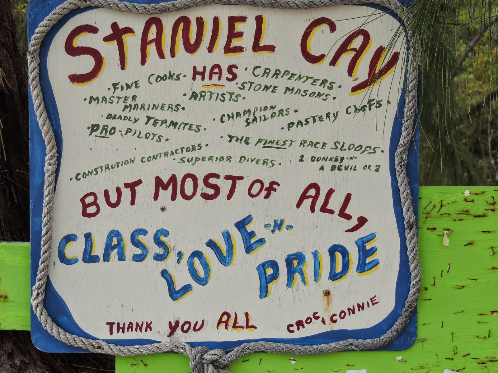
We had read nice things about Staniel. This is where one can feed the ‘swimming pigs” and is also the location of the grotto made famous in the James Bond movie Thunderball. I had also decided to take on about 100 gallons of fuel – not that we were running out but because I had not been paying proper attention to the fuel balance and Tide Hiker had quite a list. We had been watching a thunder storm develop as we approached so as soon as we made it thru the entrance we made a bee line to the fuel dock (and after waiting 10 minutes for help in the strong current) made Tide Hiker secure. Then the heavens opened up.

The attendant said we could stay while the storm persisted. Deidre attended to the fuel. We are a bit apprehensive about fuel quality here and so she loaded it all in one tank so we could isolate it if necessary. I took the opportunity of running up to the BATELCO store to buy a new SIM card for the iPad. The rain was pouring down, I had the iPad protected in a plastic bag and under my coat. I got to the door (at 12:50 PM) only to find it locked. There was no shelter, the rain was coming down in buckets. I could see people inside so I knocked (was ignored) knocked again (just embarrassed faces) and kept this up till I got a reaction. After a few yells thru the door I was told that it was lunch at 1:00 PM. They eventually let me in and after 30 minutes I had the new chip. Talk about Bahamas “Customer Service”.

We asked about a couple of mooring balls we had seen on the way in. We were told it was ‘first come first served” and that someone would visit and charge us $20 a day. They were in a prime location so we headed back. There was a lot of current and it took us about 6 tries before we snared the ball.


What could I add?
Once secured and settled, we headed into town to do some shopping and have a look around. Talk about a dump. This was the most ram shackled place we had visited. What a shame. The marina was the only place that had seen a broom and a coat of paint for many moons. On the way back we stopped at the marina restaurant and had a beer.

We watched the “Thunderball” movie and went to bed.

Please note the chicken
At the super market
Saturday April 26, 2014
One of the swimming pigs


Took the dink over to see the pigs.  It was a nice run, about a mile to a beach and anchorage called “Big Major Spot”. We were quite surprised to see about 20 yachts and trawlers anchored there. We motored into the beach and did “the pig thing”. It was quite fun. Our objective was to get close enough for a few photos but not too close where they could slice open the side of the dinghy. Deidre had brought a bag off carrots.Then back to Tide Hiker via “the grotto”. Deidre waited in the dink  while I swam in. It was “OK” but certainly no big deal. Back to Tide Hiker for lunch and a snooze. We were disturbed by a large float plane landing very close to us. Took some tourist swimmers over to the grotto.
More bloody tourists


Deidre, they are more scared of you!

One of those "Row yourself over the Atlantic" boats

Wednesday, April 23, 2014

Warderick Wells

Monday April 21, 2014

Another disturbed night. Some weather came thru and roughed us up. This is a windy place. The anchor alarm went off at about 5 AM. We had not dragged, just done another ‘360”. It turned out to be a nice morning.

Deidre thought I needed a treat and cooked eggs and bacon while the gen was running.

We were headed for Warderick Wells where we expected to meet up with Don & Barb on Cavara . I decided to go “outside” rather than “inside” and so we headed for Highbourne Cut. The tide was running so the water was quite broken up and squirrelly as we approached. To the extent that I could not reconcile what I was seeing in front of the boat and what the chart plotter was saying, so I bailed out and reversed course. We tried again with the same result.

That is when Deidre was able to point out a couple of “range markers” and that helped me a lot. Third time was a charm and we were through. The next 15 miles were bliss. The water was super deep (2,000’ and more) and calm. The course was a straight line. Deidre made lunch. Life was good.
  
We were able to make radio contact with Cavara about 10 miles out. They had already lined up a mooring ball for us.

It was an easy entry into the very narrow mooring ball field, abut all went well and we were quickly secure. Don & Barb came over in their dink and we enjoyed a good chat and a couple of beers. Don was barbequing a “London Broil” for dinner and we were invited.

The location was spectacular, tucked in a passageway between a group of low islands. The water was those spectacular colors that are hard to get used to. The area was scattered with white sandy beaches and coral reefs. Quite beautiful. Lots of photos.

Park Headquarters
Dinner on board Cavara was fun. Barb and &Don had been in a different part of the Bahamas and so there was lots of information to swap.


Tuesday April 22, 2014

Deidre and I took the dink into the park service dock and paid the mooring fee. Its a very isolated and casual place. The two staff people live in a shed on sight. There is maybe 1/2 dozen boats here. The water is so clear it is hard to see. We are surrounded by little islands.

Glass bottomed bucket
After paying our fee we rode the dink over to a deserted beach and just lolled about in the shallows. This afternoon we went snorkeling. There was a fair current so Don tied a line from the dink around his waist and we all drifted along together.

Dinner on Tide Hiker


Wednesday April 23, 2014

The "Park Service" here offers wifi internet access. For $15 you get service for 24 hours up to 100 KB. I bought my pass today and saved it until after dinner so I can get my $15 worth. There is no BTC service here so the iPad is not connecting.

Paradise found
Deidre suggested a picnic on a deserted island. We loaded the dinks and headed out around noon. The beach we chose was just amazing


Thursday April 24, 2014


I started emails this morning and my pass ran out - we had reached our limit. So I went ashore and upped another $15. On the way back Deidre found a sand bank she wanted to play on.

Spent the morning trying to catch up on emails and I am now concerned that I may have used up most of the 100 kb allocation. Oh dear.No more photos on the blog till I have done my "wok".

Highbourne Cay Anchorage

Sunday April 20, 2014

The morning was overcast and the wind was still blowing, but the forecast did not look all that bad, and we needed to make a move.

The route was somewhat circuitous.  First we had to retrace our steps from Friday and work our way out between the reefs back into the Northeast Providence Channel. Then we would be out in deep water for about 15 miles and then enter the “Great Bahama Bank” through the Fleeming Channel. According to the guide book the channel was also “subject to rages” in the wrong conditions. But the wind and tide were on our stern so conditions were basically OK.

The first few hours were quite unpleasant. The seas where very rough and disorganized. Lots of stuff on the boat was crashing around, including the crew. After an hour or so I remembered that while we were anchored I had opened the portlights in the Vee Berth. I raced down to close them to find sea spray in the Vee Berth, all the stores and bedding were soaked. What a mess.

The ride settled down a bit as we got into deep water and were able to put the wind and waves more on our stern. Not great, but OK. We put away the woopee bowl.

Entering Fleeming was simple enough (thank goodness for Chart Plotters) and then around the Quintus bar and on to the Bank proper. We took the depth readings at face value and kept in the deeper water. The course from there to Highbourne was now basically a straight line south, the challenge being to spot and avoid the numerous coral heads. But we were totally alone, not another boat in sight.

The conditions for “Visual Navigation” seemed OK, it was “sunny to partly cloudy” and just a moderate chop on the bank. The “problem” was still that neither of us knew what a coral head actually looked like, so we were not too sure what we would be avoiding.
  
Coral Head!
It was turning out to be a decent day, the sun was shining most of the time. We figured we would know what a coral head looked like when we saw one. And we did. That was a relief. And except for when the sun went behind a dark cloud we felt OK. They came in random patches, bit like crab pots. We now had a magenta line “Fleeming to Beacon Point”) and so as we avoided the coral heads we headed back to “the line”.

By 2PM we were “out of the woods” and by 4 arrived at our target anchorage at Highbourne. There was a big boat (maybe 150’ feet) in the area. This was the first boat we had seen all day. There was plenty of space and we found a patch of sand and dropped anchor. We fell back too close to the beach so recovered the anchor and moved another 100’ off the shore.

It had been a hard day on top of two nights of poor sleep.

We had obviously picked a popular spot. By dark Deidre counted 14 boats, including 4 “real boats”

There was a large BATELCO tower on the hill up the beach, so 3G reception was good. We made contact with Barb and Don and a meeting place was set for the next day. 

Current Cut Anchorage

Friday and Saturday April 18 & 19, 2014
25 24.800 N
76 47.350 W

Today we had planned to “take a day off” and ride the “fast ferry” thru “the Devils Backbone” to Paradise Island. The “Devils Backbone” describes the maze of coral reefs that line the northern coast. Paradise Island was reputed to be a very pretty place and a bit touristy.

Then we realized that it was Good Friday, and this being a religious island the place would be virtually closed down. Also the day would cost us $170 in marina and ferry tickets, so we decided to give it a miss and begin our trip to the Northern Exuma Islands. We had heard from Barb and Don and had a meeting place set up. The weather forecast was not so good so our intermediate destination was determined by finding a good place to anchor out of expected strong easterlies. The choice was a bit limited so we opted for a short run to an anchorage near “Current Cut”.

The wind was quite strong as we crossed the bay (it does not seem to have a name)  and we were pleased to get into the lee of Southern Eluthera. The wind was still quite strong but the water was protected and reasonably flat and we were anchored in deep sand.

That afternoon I spent a lot of time planning the next day. The challenge is that our route is not a common approach to the Northern Exumas (Our target is Highborne Cay) and passes thru several areas of reefs that are “not fully charted”. Plus the various charts and guides emphasize that you need a reasonably calm and sunny day so that you can navigate around the coral heads that dot the area, using “Visual Navigation Skills”. The more I worked on the route the more apprehensive I got. Nevertheless we planned to weigh anchor at 7 AM so we had a full day for the 60 odd miles.


Saturday, April 19, 2014

We are still at the Current Cut anchorage. The wind got up last night and we had a disturbed night. Deidre had a really bad “bogyman” nightmare. I got spooked by the wind and noises and was up checking the boat “all night”. The boat was bouncing around a lot, it was pitch black. This morning was overcast, stormy looking and windy. Not a good day for “Visual Navigation Skills” so we did the prudent thing and decided to stay on the hook for the day and try again on Sunday.


I am pleased we did as the wind remained “brisk” and wealso  experienced several squalls during the morning. It was a long rough day. The wind moved around the compass so that by nightfall it had a lot of west in it – not good for us as we were now on a lee shore. I recon the gusts got up to 40 mph. The boat had rotated over 180 degrees, asking the anchor a lot. I was up a lot during the night, it was hard to settle.

Spanish Wells

Thursday April 17, 2014
25 32.469 N
76 45.379 W

Restful night. After two “pain killers” on Mud Puddle Rose I ended up back on Tide Hiker and in bed by 9 PM. Next morning there was nothing to keep us in Royal Harbor so we headed for Spanish Wells hoping to get a mooring ball. No dice, so we took a slip at the one and only marina. We were towing the dinghy but I was advised to back the boat in. So Deidre grabbed the towing harness and dragged the dink around to the bow where she secured it under the flag pole. We then backed in OK.

The slips were old but solid. The facilities ashore were primitive to say the best. Seemed like the place was being rebuilt and the site was a disaster. To get to the office we had to clamber over building materials and the wreckage of demolished buildings. In the “office” I politely suggested they gave us a “construction site discount” but no dice.

We had arrived about 11AM so we had the day ahead of us and so unloaded the bikes and toured the island. The island was maybe 2 miles long and ½ mile wide at its’ widest. The Island was named because the Spanish galleons stopped here to take on water. The Eleuthera Island group (of which Spanish Wells it is a small part) was named after a religious group (“escaping persecution in Europe”) that was wrecked on the island in the 1700’s. By Bahamian standards it is “busy” because the harbor is home to one of the larger fishing fleets.

Exploring the harbour
We were looking for lunch but turned our noses up at the typical Bahamian places, but then came across a restaurant overlooking the beach that looked like it had some class. And the food turned out to be decent. Then rode back thru the fishing part of the port to Tide Hiker. Later in the day we investigated the island from the dink. 

Royal Harbour

Wednesday April 16, 2014
25 30.881 N
76 50.724 W

Anchor was up sharp at 7 AM about 15 minutes after sunrise. The cut/entrance/exit from the Sea of Abaco between the islands was a bit choppy but otherwise easy. The sea state in the Atlantic for the first few hours underway was “confused” and we both felt a bit queasy. The stabilizers were earning their oil. The southerly breeze was on our nose at about 10 to 15 kts. Mid-morning we were watching a big squall developing to our west. The clouds were dark and the sea underneath an inky blue. It seemed to be moving north east as we headed south and so we thought we might slip past us before it reached us. As it got nearer the wind turned west at about 15-20kts and we could see the deluge heading to us across the water. It rained for maybe 30 minutes and then it was over. The rain was heavy enough to “flatten the water”. The sun came out, the wind reverted to south and the chop had disappeared, leaving the underlying 3’ swells, making our ride a lot smoother. As the miles slipped by the conditions continued to improve

Squall
We were crossing the NW Providence Channel. In parts it was 14,000’ deep. We spotted two large ships, a couple of flying fish, but that was about the sum total. We made the turn around Egg Island at about 2:30 PM. As we did we saw a huge turtle – he looked at least 6’ long. By the time I found the camera we were past him.


The anchorage at “Royal Harbour” (on Royal island) is an improved natural harbor. It was deepened by a resort developer but the project was never completed.  We seem to have heard this story frequently in the Bahamas. But it is a great anchorage for cruisers, although there is nothing ashore. We anchored in about 12’ and launched the dink to have a look around. There was a dozen boats in the anchorage, including 4 trawlers (Nordhavn, Grand Banks, Hampton and DeFever) We stopped and had a chat at several boats, ended up enjoying a “painkiller” on Mud Puddle Rose. 

Lynyard Cay


Tuesday April 15, 2014
26 21.358 N
76 59.200 W

Our target anchorage was just inside Lynyard Cay, a mile or so from the Little Harbour Bar Channel,  was only about 4 hours from Marsh Harbour so we assumed a relaxing schedule. Paid the bill (after some discussion that led to a $200 credit) and said our goodbyes. Nice group of people waved us off at about 10 AM. The route was basically the same as our previous route to Little Harbor so all we had to do to be safe was to follow our “mouse droppings”

Beach on the "inside"
Couple of ours into the trip we were able to raise “Mud Puddle Rose” on the radio, and they were waiting for us at the anchorage. The forecast wind was south but turned out to be SE at the anchorage which served to improve the level of protection. The wind came up overnight so that turned out to be a good thing.
We dropped anchor in about 20 ft of clear water. I wanted to finish cleaning the running gear and bottom that I had started the day before. This was my first ever dive in clear water, and it was wonderful. The boat floated above me like a giant whale. I was able to do a good job on the props and rudders. Then I swam out to the anchor to see how well it had set – most of the anchor was still showing so “not so good”. The bottom was sand and weeds.  If I disturbed the bottom the sand billowed up like smoke. I was able to easily push my arm into the sand, so I resolved to fire up the engines and re ‘set” the anchor later.


Cleaning the running gear
Mud Puddle Rose had their dinghy in the water and invited us to explore the beach and island. The ocean side was very rough with limestone rock eroded into a labyrinth of sharp angles. Not good walking. The bay side was sandy and shallow and the water was warm. We invited Joe and Susan over for a drink and to plan the crossing. Dinner was a curry.

Monday, April 7, 2014

Back to Marsh Harbour

Sunday April 6, 2014
26 32.782 N
77 03.175 W

Another beautiful morning. However the forecast indicated that the weather was going to fall apart Monday/Tuesday so we decided to head back to MH. There was no big hurry so we enjoyed a lazy morning then jumpted into the dink to have a better look around,.

It seems that Treasure Key was a "planned development" where the investor(s) must have lost their pants and their underwear. Lots of canals had been dug and walled for "miles" It was quite impressive but no additional development had followed. I made a note of the wide empty canals as a potential "hurricane" hole anchorage.  (Not that we ever expect to be in this area during the season)

We dropped the mooring at about Noon and headed to Archer Cay area to have a swim on the way home. It looked interesting - we anchored about 1/4 mile off shore - but it really turned out to be "just OK". Swede Dreams was with us (More accurately we were with them.) As we were messing about in the dinghy and in the water the wind started to pick up and Deidre and I decided to split.

As we rounded the point the wind was quite strong. Nothing to bother Tide Hiker, but I was thinking about backing Tide Hiker into the slip in the wind. But MH and the marina were in the lee, so it turned out to be no big deal. So that we could have use of the dink while we were at the dock (we are tied 'starboard to" which means we cannot launch the dink when tied to the dock) I had decided to leave the dink in the water but secured "side to side" across the swim platform and back into the slip with the arrangement.

All went well. We were both tired so I suggested dinner out at a new place. When we saw the menu we both decided to eat modestly - Deidre had a bowl of soup and I had an appetizer salad and a glass of wine - still added up to $50.00. We came home and had some toast.


Lots of canals but no houses


Monday April 7, 2014

Today I sent out over 20 emails, some with multiple addresses. As of Tuesday morning I have not received one response. Seems like we are back in the 5th Dimension once again. Gmail seems to work so for now we are reverting to Gmail.

Decided to change the macerator pump - on a hunch, before I started dismantling, I removed the holding tank vent hose and "lo and behold" the pump worked. It seems like wishful thinking, but maybe the slight vacuum the pump creates prevents it from priming.

Tuesday April 8, 2014
Not much going on. The weather is stormy. Lots of reading. I eventually got my rear off the couch and into the dinghy and cleaned the mustache off the bow. The gave it a coat of wax. Working around Tide Hiker in the dinghy is very awkward.

For a change we purchased a "Captain Phillips" DVD from the local movie pirate for $5. Watched it after dinner. Was "strange" in that the Somalia language parts were subtitled in what looked like Korean. So we understood what captain Phillips understood - nothing. Good movie, even so..

Wednesday April 9, 2014
Very stormy night. I was up in the middle of the night checking out the boat. Our dinghy was jammed between the boat and a piling and taking a beating. Various items had blown over. This morning another boater turned up with one of our fenders that had blown off during the night. As a result we slept in until after 9 AM. Went over to another marina for "Rib Night" - wet ride in the dinghy

Thursday April 10, 2014
Having more problems with Cox email today - now we cannot even receive. What a pest.Amazingly, Kylie Skyped us this morning and it worked well, video and all. They both looked very well.

We are trying to make plans for the next stage of our trip to the Exhumas. Looks like we might have a weather window next Wednesday. I would say that we are ready to move on.

Went to a "meet and greet" at the Royal Marsh Harbour Yacht Club last night. It was a bring a covered dish party, and we were not too sure what that meant. We had a fun time and met some interesting people.

Friday April 11, 2014
Quiet day. Few jobs around the boat. Weather window still looking OK for next week.

Saturday April 12, 2014
Not much going on! Went to Mangoe's for breakfast. Cold front came thru today bringing wind and cold rain. I rode a bike to the Post office and the supermarket and came back sopping wet. Billy came over for dinner - chili. watched another movie.

Sunday April 13, 2014

Monday April 14, 2014


Tuesday April 15, 2014
We plan to get underway by about 10 AM and will probably be "quiet" for several days.


Friday, April 4, 2014

Treasure Cay

Friday April 4, 2014
26 40.257 N
77 16.940 W

There are 12 mooring balls in the anchorage at Treasure Cay and I wanted one of them, so we were under way by about 9 AM with a 12 Noon ETA. It was sunny and relatively calm day. We were in the anchorage by about Noon and on a ball shortly thereafter. Every ball seems different and this one was difficult, but we are old hands now and after 4 tries we managed to snare the ball. After a couple of hours all the moorings were taken.

The anchorage - nice and busy
The anchorage/mooring field is super protected. There is room for anchored boats to mix with moored boats. Once we were secured we headed ashore to pay and get the WiFi password, and have a look around. The marina is only about 20% occupied. I do not understand why places like this do not reduce their prices till they fill up their slips. This place just seems to be a wanna be "Florida style resort" but with "Bahamas style" maintenance.

I had brought my computer and hot spots with me because I had heard there was an " Bahamas internet" guru here. I found the place and explained
Sunset
my problem and unloaded all th gear. Within a few minuted I realized the lady knew less about the issue than I did and all I wanted to do was get out of there.

We walked over to the "one of the 10 best beaches in the world". Certainly a nice beach, but I suspect the local Chamber decided upon the rating. We will come back tomorrow for a swim.

Back on the boat the wifi worked well and I hope I reconnected with the rest of the world. :) Beautiful sunset and sunrise (the latter according to Deidre).


Saturday April 5, 2014


Perfect morning - not a cloud in the sky, by 11 AM it was 80 degrees and 50% humidity. I had some work to do and since the internet connection was so good, now was the time to do it. In the midst of this Charlotte popped over on her paddle board and gave me a lesson. I paddled back to Tide Hiker and got back to work. The Kylie called and we 3 chatted for a good 30 minutes and then I called Bill on Skype. It was good to be back in touch.

Last night I had noted that some fuel or anti freeze (they are the same color) had accumulated in the ER bilge so I this morning I cleaned it out and strategically placed some shop towels to help me figure out the source. While I was at it I opened the forward bilge and vacuumed out a few gallons till it was dry. Now that I have eliminated the leaky toilet I am wondering if I have solved the two year search for the source of the bilge water.

Banana and Nutella sandwiches for lunch, and we headed for the beach to work on our tans.
Paddle board lessons

Treasure Island Beach

Mermaid in the water


Man-O-War

Thursday April 3, 2014

The new forecast looked good thru the weekend so we decided to extend our sojourn to a couple more islands. Man-O-War Cay was only 5 or 6 miles away and had an interesting story, so we headed out. Because of all the shallows and reefs, nothing is in a straight line, and it took a couple of hours to make the entrance.

The entrance (on the way out!)
The entrance is deep but VERY narrow. Entering places like this the first time is a bit spooky, but mainly because the cruising guides make it sound that way. Now that we have been in and out, we can say that you do need to be careful and that the first time is a bit tense. I would not like to do it at night, I would not like to encounter another boat, and the chart plotter had us crossing the land.Other wise it was easy.

Man-O-War is "dry" and "religious". About 70% of the population of Man-O-War can trace their heritage back to one person. It is neat and tidy and
Cool house
all the people look the same. It has a boat building history, but now it seems all the trees are gone. Deidre and I walked around for an hour or so and decided that one night would be enough.


Wednesday, April 2, 2014

Hope Town


Monday 3/31
26 32.217 N
76 57.499 W

Hope Town Harbour: Can you see Tide Hiker?
Weather looked decent at last. We were both a bit sick of the dock. As I have said may times, getting underway after a spell at the dock involves a fair amount of effort. We left some lines on the outside pilings so they would be handy when we returned. We were underway by 9:30 AM and it felt good.
It was only a couple of hours run to Hope Town. We hoped that a few of our friends would follow us over there now that the weather had broken.

Apparently March/April is when the winter visitors start heading back to Canada and parts North. Today was the first decent weather opportunity for some time and as we headed around XXX XXX there was a steady stream of sailing boats heading North. The Hope Town harbor is too small for anchoring so we were hoping to nab a mooring. Ended up that we had the choice of several. We radioed the good news back to friends.

My flower girl
Hope Town is one of the original “Patriot” settlements. The harbor is maybe a ½ mile in diameter, very well protected with a narrow but deep entrance. First impressions was very good – buildings looked better built and cared for. “Independence” (Ricky and Dawn) followed us in and also grabbed a mooring. We both launched our dinghys and headed ashore. The next couple of hours we wandered around town. I was a bit concerned about Deidre's various injuries but she held up OK. We bought a sandwich and a beer at a cute little place and ate it in the sun.

Swede Dreams arrived later in the afternoon. We invited Independence and Swede Dreams for drinks on the boat deck followed by Deidre's "Sweet and Sour" chicken dinner.Good day.


Tuesday
Swede Dreams was heading to Little Harbor for lunch and invited both other boats. That night Dawn received news that her mother had fallen and broken her hip and was in a coma. So they were headed back to Florida.  

Back beach Hope Town
We transferred to Swede Dreams and tied our dink to their ball. It was fun to be a passenger on another boat with no responsibilities. The run to Little Harbor was uneventful and lunch under the palms at Pete's Pub was fun. Deidre’s foot is still tender but she did OK getting on and off the dinghy. In Little Harbour we saw quite a few sea turtles and some very large black sting rays. 

On the return trip we stopped and Sand Cay reef and snorkeled. It was an impressive reef, “quite” mountainous” and quite healthy looking. We were not back on Tide Hiker till about 8 PM.

Fishing on the way from Little Harbour
The solar panels have not been the “great solution” I had hoped but still a “good contributor”. I still have to run a generator in the morning and before we go to bed, but not during the day at all and for less time in the evening. We were away from Tide Hiker for almost 11 hours today and the batteries were still at about 80% when we returned.


Wednesday
The weather has really been delightful. Temps are in the hi 70s and low 80s with little humidity. In the morning we dinghyed over to the "new marina" to check it out for dinner. Looked expensive. Then landed at the base of the old lighthouse and had a look I climbed up the inside and had a look at "the works". It still operates, but the light and mechanism is 100 plus years old.The view from the top was good.

Starfish at Tahiti Beach
This afternoon we took the dink about 5 miles to Tahiti Beach with Swede Dreams. That is a long run in the dink but the new motor will plane us at about 80% throttle. We moored the dinghies in shallow water and spend the afternoon on the beach. 

Stopped at "Cracker P's" bar on the way back. These waterside bars seem a characteristic of the area. They are rather "rough and tumble" and would not pass the Health Department requirement in the US, but definitely have character.


Thursday Morning


Cute house Hope Town
By now I was aware that emails I had been sending from Marsh Harbour had not been arriving, even though they had been shown as "SENT" on my computer. Up until today I was assuming that people were just not responding, but we started getting  "Where are you?" emails. So we went ashore with the ever reliable iPad and found a place with wifi and I spent an hour or so re-establishing contact.