Sunday, May 31, 2015

Lock 8 near Scotia (Free wall)

Sunday May 31, 2015
42 49.867 N
73 59.588 W

Wet and windy day. Five boats headed out to the first lock (Lock #2!) at 8 AM. From the beginning the 5 boats did not play well together, and the weather was lousy. The sail boat was first - it was slow and did not move deep enough into the lock. (And slow is a problem for Tide Hiker and Cavara - we need to be moving to maintain control and overcome wind and currents - we do not drift well.) The second boat was a large power-cat - with maybe 25' beam? It secured itself behind the yacht, and because it was so bloody wide no-one could get past it in the confines of the lock. That left very little of the lock for the three trawlers.

We squeezed in. At this point the lock keeper needs to call all the boats on the radio and sort them out for the next lock - at this point of the canal there are 5 locks in less than a couple of miles. All boats should be monitoring Ch. 13 in the locks. Nothing but silence.

The next lock was worse - the wind had picked up, making it very hard for the trawlers to stooge in very confined space while the yacht and the catamaran cluttered up the next lock at a snails pace. At one point a strong gust of wind hit Tide Hiker and pushed her 20' sideways into the canal wall - all I could really do was use the engines and bow thruster to keep her parallel to the wall so the fenders could absorb the impact. Fortunately we "bounced" off, with no damage.

Cavara does not have a bow thruster and had a harder time maintaining control in the wind at slow speed. As she entered the second lock the swirling wind grabbed Cavara and at one point she was pushed 45 degrees to the lock with her stern pinned on the wall. Somehow Don extracted her, but with some minor damage to her rub rail. Still no leadership from the lock master.

In the meantime the rain continued. The dock lines where covered with mud and slime, and that collected on us and the decks. Deidre had just about every towel we owned in service on the floors and seats. We both looked like drowned rats. I was still having fun - not so the Admiral!

 I have no photos of this mess because we were keeping a busy. We were lucky and made it thru the first 5 locks in one piece. Called it quits after 7 locks and about 18 NM.

Hunkered down in the wind and rain. Note that the mast and all the aerials are down. Fenders ready for the next lock. 


Amtrak in the rain

One of the locks - Cavara in the lead

Settled for the night - bulkhead Lock 8


Thursday, May 28, 2015

Waterford, NY (Free Slip!)

Thursday May 28, 2015
N
W

I really like this place. Waterford is an "inland port" and very boater friendly. We have a slip here with water and electricity for $10.00! There is a total of about 500' of floating dock, full of transient boaters, mostly heading into or out of the Erie canal system or continuing on the Lake Champlain. We have just been out to dinner in a group of eight people from the slips.

Easy day today - anchor was up at 6:30 AM and we were safe and sound in Waterford by 11 AM.

Barge traffic on the Hudsaon

Hey! That's my truck!

I do not have a clue what they are!

Albany

Definitely not free range parents

My lock hand
Friday May 29, 2015

Out for breakfast - 2 eggs on toast and bottomless coffee is $2.65! Deidre and I enjoyed our two eggs with "the works" and our total, for the two of us, was $12.65. I love this place! Then off to the supermarket we spent over $300 for two buggy loads. I think we slept the rest of the day........

Four Aussies, one Brit and two Yankees. (Really can't ask the Brit to leave?) 

Saturday May 30, 2015

Walked up to the first lock and bought our pass. Went for a bile ride along the old Lake Champlain canal. Had a sleep for a few hours. Moved Tide Hiker up to the pump-out and back. Hosed the salt off the boat. Busy day!


Athens (Anchorage)

Wednesday May 27, 2015
N
W

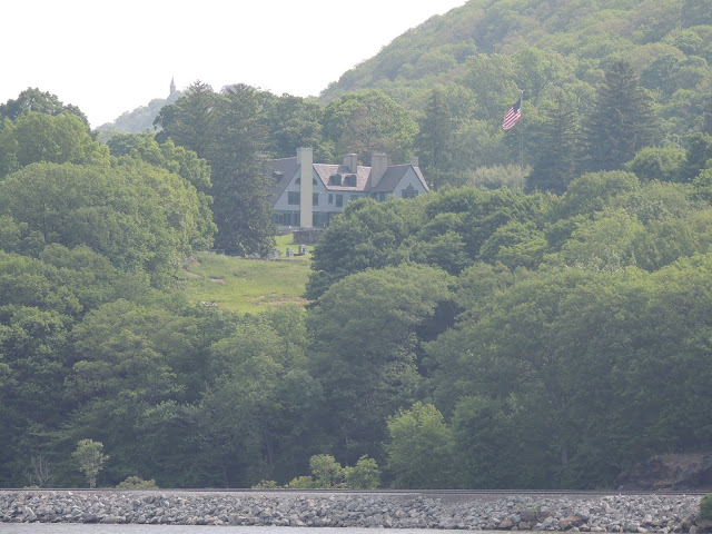
Big day. Underway at 8 AM. Today we would be heading up the Hudson where it cuts thru the Catskill mountains, and passes West Point at the "World's End" bend. It was a bit overcast so we did not enjoy the scenery at its best, and I know its not the Rhine, but it was pretty impressive. A hundred years ago the Hudson Valley was quite an industrial place. Not so these days - by and large the shoreline is very green and well care for, with a rather constant display of impressive but well spaced "manors". A fun part for me are the trains - a constant flow of Amtrak on the east bank and huge freight trains on the west bank.

Our target for the day was the little town of Catskill, where we planned to rent a slip and drop our mast - same as two years ago. And maybe have dinner in town. But Barb and Don suggested an anchorage and volunteered to come over in the dinghy and help us drop the mast at anchor. So that became the new plan.

All day we had been reading/hearing of a large line of intense thunderstorms that would arrive late in the afternoon and ruin our day. They certainly looked impressive as we watched the line approach on the radar. I was hoping they would hurry up and arrive, as we much prefer bad weather when underway rather than when anchored. The storms arrived about 4 PM and were a bit of a fizzer - some lightening, some rain but no wind.

We anchored about 7 PM and true to their word Barb and Don arrived and helped us with our mast. Its amazing how things are so much easier the second and third time around. Deidre had been cooking a stew in the crock pot all day and by 8:30 PM we were into it.

I know its not the Rhine, but sure can be pretty

Nice shack

And another

West Point

"Worlds End"

Lots of freight

Tourist ride at some river town..........

Cute old lighthouses

A rare sight - old foundry

These poor Canadians were hard aground - need to pay attention!

Another one near Athens

Tuesday, May 26, 2015

Croton-on-Hudson (Anchorage)

Tuesday May 26, 2015
41 11.714 N
73 53.727 W

Today the God of Tides deferred to Deidre this AM and as a result our departure was delayed until 10 AM. Even so the tidal current on the Hudson River did not catch us until about the George Washington bridge. The cruise thru New York harbor past Manhattan was pretty straight forward - our 6th time - ho hum!  But we did feel obliged to take some photos. The navy must have been here in force for the Memorial day weekend so we had some front row seats for the parade of ships as they left.

Our anchorage is about 40 miles up the Hudson and is quite delightful. The river is now running thru low hills, Tomorrow our surrounds will be more mountainous as we pass West Point. It is a beautiful river, not quite the Rhine but definitely impressive. the weather was great today.

One of the navy ships heading out

We  already have a hundred photos but......

Just a pretty picture

One of those new stealth ships

As usual the NYPD was everywhere

Bangladesh ferry

The three new buildings in front of the "Freedom Tower"

The Concord on display

New fancy building under construction

I think the George Washington bridge was inspired by Mechano Sets

Where the Harlem river enters the Hudson River

The Tappan Zee bridge is being overhauled - we counted 20 cranes on barges

Sandy Hook (New York) Anchorage

Sunday May 24, 2015
N
W

What a great day!
It’s very important to catch the tide and current down the Delaware. The total current can run 3 knots for or against you, so it’s a “6 knot decision”, and for a 7 knot boat that seems important! The end result is that we were up at 5:00AM and underway by 5:30AM. Deidre asks: “How come the tide always seems to change so early in the morning?”
But both boats timed it right and we immediately picked up a couple of knots from the current, and rode it almost the whole 47 miles to the Cape May canal entrance. It was “Memorial Day Weekend” so we expected a bunch of New Jersey style boat traffic. In fact they all turned out to be reasonably cooperative and polite. As planned we cruised through Cape May and out into the Atlantic - “in one end and out the other”.
The plan was to continue north up the Atlantic coast about 35 NM to Atlantic City and anchor for the night. Conditions on the Atlantic were not great, but not bad – 15-20 kt wind from the south with well-spaced swells on our stern and some chop, conditions well within Tide Hiker’s comfort zone. Tide Hiker immediately picked up half a knot from the wind or the swells or a current, and were progressing at 7.6 to 7.8 kts, great!
The weather was predicted to worsen tomorrow and stay that way for a while. It was only another 80 NM to NY harbor so some time in the afternoon we decided to stay in the Atlantic and travel overnight to NY. Once we get to NY we will be in rivers and canals for a month or so and weather would be less of an issue. So Don and I re-plotted our courses and sorted out “who was to sleep and when”.
Deidre took the first 2 hour shift 8 to 10PM and I slept.  The moon was out until about 1 AM so we had some visibility. Conditions stayed the same and we continued north averaging about 7.7 kts. There was not much traffic around. Most of the time the radar picked out markers and buoys to avoid. We chatted between boats on Ch. 17.
The fun started when we arrived at the entrance to NY harbor (Sandy Point) at 2 AM. We could see the Empire State building and the new “Freedom Tower” lit up in the distance. But the moon had set, there were lots of lights, the radar was “cluttered up” but otherwise it was pitch black. We used the chart plotter to maneuver into the shipping channel, and Deidre stood in the dark on the Portuguese Bridge, spotting channel lights and looking for shipping.
We were monitoring the VHF radio for traffic. Also, as we entered the channel we broadcast: “Securite, Securite – This is inbound motor vessel Tide Hiker , entering the Sandy Hook Channel at Green 1, any concerned traffic may contact us on Channel 16.” This is the appropriate protocol at night.
Half way into the 5 mile long shipping channel Deidre calls out “I think I see a ship coming towards us. A big ship!” I did not quite believe her, all we could see was a couple of weak white steaming lights, what might be a red running light, and a large dark “blank spot” in our view. Usually large ships are lit up like Xmas trees, and at night she should be broadcasting a Securite warning call. But Deidre was right – in a few minutes a HUGE ship was visible and close, and started blasting its horn – 3 shorts and a long (I have to look that up in Chapmans). But we were well positioned, and now that we could see the ship it was obvious it would pass.
Once we were in the harbor we turned south out of the channel and headed to an anchorage. Inside the harbor the water was protected and dead calm. The anchor was down and secured by 3 AM and we were asleep shortly thereafter. What a great day – 165 NM in 22 hours.

Sandy Hook Bay
Memorial Day, Monday, May 25, 2015.
40 25.019 N
74 00 850 W

After a beautiful sleep we took Tide Hiker into the fuel dock at the Atlantic Heights Marina. This place has the best fuel price in the Hudson Valley. From now on the price of fuel will increase until it peaks in the Canadian outback. We will top up again just before we leave the USA, maybe in Oswego. We had travelled 389 NM since Top Rack, and took on 202 gallons here, so it seems we averaged 1.925 NM per gallon – pretty good!

We have now anchored back in the bay for a day of rest. Tomorrow we head up the Hudson. 

View from our Sandy Hook Bay anchorage

Reedy Island (Anchorage)

Saturday
39 30.800 N 
75 34.300 W

Today was almost the opposite of yesterday. It was still a bit windy but the sun was shining and the we rode a favorable tidal current almost all the way to the C&D. We had planned to anchor just before the C&D at Bohemia Bay, but we were running ahead of plan and decided to continue the 22 NM thru the C&D and anchor in the Delaware river at Reedy Island.

FYI, the "Chesapeake & Delaware Canal" is a wide and deep canal that joins the north end of the Chesapeake Bay to the Delaware River. It is a "ship canal" so ships can travel from Philadelphia to Baltimore and Norfolk without venturing into the Atlantic.

The Reedy Island anchorage is not a particularly desirable anchorage - the current is strong and "turns" every 6 or so hours with the tide, which really tests an anchor. (Also, the most obvious part of the view is the nuclear power station immediately across the river.) We took two tries to get the anchor to set. We had deployed all 200' of anchor chain - my theory being that as the tide changes and the boat starts to drag the chain along the bottom in the opposite direction, there is a good chance the chain will snag on 'something" and take the load off the anchor.

Tide Hiker's main engines hours had built up to 200 hours since the last oil change, so after dinner Deidre and I headed to the engine room to change the oil and filters. We are getting quite efficient at the task and were done before 11 PM. I stayed up a bit longer to watch the tide change.

This ship came out of the C&D as we were entering

Coast Guard boat changing the channel buoys from winter to summer buoys

Saturday, May 23, 2015

South Kent Island (Anchorage)

Friday May 22, 2015
38 51.090 N
76 20.985 S

Getting north to NYC seems to be a bit of a battle. The weather is just not cooperating. The forecast this AM included another SCA plus we had to cross the entrance (exit?) of the Potomac River into Chesapeake, where it is notoriously rough.

We were very tempted to stay put. The Mill Creek anchorage was so comfortable. But we need to get north, and also to deal with inclement weather because we will probably need to deal with a lot worse in the Canadian Maritimes. So with the understanding that we would probably get the snot beaten out of us as we crossed the Potomac, we upped anchor about 8 AM and headed out. At least the morning was sunny, not like the cloud/fog/rain we had yesterday.

Between the wind and current we were down to as low as 5 knots crossing the Potomac, and it was rough. We had everything pretty tide down but the crashing around found a few more week spots - including one of the bikes breaking loose on the upper deck with a crash.

It took a couple of hours but eventually we passed north of Point Lookout and the conditions settled down. In fact after a couple more hours conditions were almost "pleasant" although we pushed against the tide just about all the way. Nevertheless we used all the daylight and covered 72 NM.

The anchorage was an "easy-in and easy-out" and protected us from the forecast strong N and NW winds. We put out almost all our chain plus the snubber. The area was obviously very upscale with some very fancy house spaced wide apart around the bay. Deidre tells me the wind got up about 2 AM but I did not hear a thing.

The seemed to be a "large sailing boat" race coming south and this was the leader.

"Deidre, look out the galley window"


A couple of the "nice houses" at our anchorage. 


Thursday, May 21, 2015

Mill Creek (Anchorage)

Thursday May 21, 2015
37 47.558 N
76 19 407 W

Started off the day as planned - up at 5 AM and underway in semi light at 5:30 AM with Cavara right behind us. I called them on the radio "Turn on your running lights" and they responded "They are on" followed in a few minutes by "Our lights are popping the breaker". But that was just the start. We got out and around the Thimble Light just before we heard radio chatter between a helicopter (taking photos) and a departing nuclear sub.

The entrance was pretty rough. The wind was still up and we were exposed to the Atlantic. Just about then we heard from Barb - "We have an overheating engine and we have shut it down". We throttled back but we both continued north - Cavara on one engine, at about 4 knots as Don changed the impeller on their starboard engine. An hour or so later we were back to cruising speed.

It was really an unpleasant day. Overcast, bleak, windy, the water and everything around was gray. Deidre cooked breakfast and we were cozy in the wheel house.  Deidre was feeling a bit green and did not eat much. The wind was on our stb beam and Tide Hiker was leaning over somewhat, but otherwise handling the weather OK. One of the bikes broke lose on the top deck and needed re-securing. It was going to be a long day.

We had a long day planned - 90 NM or about 13 hours - hence the early start. As the day progressed we were watching the weather, and the forecast seemed to get a bit worse each time we looked. By 2 PM we had covered 50 plus miles but the conditions were "not getting better". Deidre hates it when Tide Hiker rolls on a beam sea and she finds herself looking down on the water from her perch on the port side.

At about that time I called Don and asked "What do you think?". We were about to pass our last anchoring possibility and still had 5 hours of cruising ahead of us to reach the target. We quickly agreed to "bale out" and immediately turned for shelter in Ingram Bay. There are several anchorages in the bay, and a very sheltered anchorage in Mill Creek. Its pretty isolated - not one broadcast Tv channel. Last night we had 45!

Passing Wolf Trap light . 

Fishing boat


Wednesday, May 20, 2015

Willoughby Bay (Anchorage)

Wednesday May 20, 2015
N
W

Unfortunately the weather had deteriorated further during the night and conditions on the Chesapeake do not look good. So we met again and decided to just complete the Elizabeth River section of about 15 NM (?????) and anchor just out of the Chesapeake in Willoughby Bay. And here we are, a couple of hours later.

The interesting part is that we are anchored adjacent to the Navy Air Base and there is a lot of air activity around us. Lots of helicopters overhead - I think they are probably just running messages for the Admiral's wife.

We were scrutinized (Cavara in the background)

The "Ike"

View from our anchorage
All around us - the Marines doing their thing.

Tuesday, May 19, 2015

Top Rack Marina

Tuesday May 19, 2015
N
W

I found the Yard Manager when he was having his coffee at about 7:30 AM. Seemed like a nice guy. The upshot was that he would arrange a haul that morning.  I returned to Tide Hiker to eat breakfast and wait.

At Noon I tracked him down again. Usual stuff "busy morning etc" but he agreed to come for a ride to listen to the noise. He arrived when promised and we headed up the river. His immediate conclusion was "singing prop" - not doing any damage and the only solution would be to haul the boat and send the props out to be tuned. Bugger that.

We dropped him off, called Barb and Don, and caught the 2 PM opening of the Great Bridge bridge and lock. The weather was predicted to turn bad so we only went a few miles to Top Rack where we took an hour or so to load fuel and water and pump out. Top Rack have the best diesel price for a 100 miles in both directions.

Tonight we took advantage of their "eat your dockage fee" at their fancy restaurant. Nice bottle of wine, crab soup and mahi mahi, all for "free". Good deal. At dinner we discussed plans for the trip north up the Chesapeake. Its a new and interesting dynamic with four opinions and data points

We resume our northern trip in the AM.


Monday, May 18, 2015

Atlantic Yacht Basin

Monday March 18, 2015
36 43.207 N
76 14.096 W

Our target for today was a marina on the Elizabeth River called "Top Rack". This is a favorite for two reasons: 1) Cheapest fuel at $2.31 tax paid, and 2) The dockage is about $80 but you can spend it in the restaurant! Great deal.

We had the anchor up at 8 AM sharp. Nice day, sunny with maybe 15 mph west wind. Unfortunately the "prop whine" was getting worse and sounds more like "metal on metal" and I was starting to get concerned. I called several people and got some input. Consensus was that I should take a look.

So after we had crossed the Albemarle Sound we found a quiet spot and dropped anchor so I could dive over the side. I wore my "shortie" wet suit, and was frustrated by the way it seems to shrink between wears! The water was not that cold but very "stained" by the run off from the swamps. Under the boat I could hardly see, but satisfied myself that all the parts were where they should be.

So we fired up the engines and moved on, thinking about "Plan B". We are aware of a large yard close to our day's destination and I called them to see if we could get hauled tomorrow morning. We are sitting at their dock now as I type this. Maybe I will ask a mechanic to take a ride in the AM and listen to the noise.


Alligator River

Sunday May 17, 2015
35 46 632 N
76 02 313 W

The big adventure started today. We were both underway at 8 AM in perfect weather. The initial target was the Belhaven anchorage with a couple of "stretch targets". Conditions were so comfortable that we kept moving and did not anchor until the sun was setting at about 8 PM half way north on the Alligator River. Was an uneventful day, except that Tide Hiker seems to have developed a case of "singing props".

The wind got up a bit as the sun was setting and we found the movement a bit unusual after 2 weeks on the hard. We anchored among a bunch of crab pots which made things a bit awkward. The wind settled down overnight for good sleeping weather.


During the day we traversed the Pungo River - Alligator River canal - 22 miles of man made canal with just one 20 degree bend in the whole length. The canal runs its entire length thru swamp grass. On the North side where the construction spoil was dumped there is enough elevation for trees to grow in a narrow band, but behind the trees is endless swamp grass. There is nothing to do other than look for critters and try and get a photo - but no dice.


The trickiest part about anchoring was finding space between bloody crap pot floats. They are such a curse, because if you tangle one on a prop it can stall the engine. Monday morning the crab-man was buzzing around emptying his pots. He seemed such a nice guy I felt guilty about the things I had muttered the night before.

This was the pattern on the chart plotter when we woke this AM. Obviously the wind and current did not change much last night. Perfect anchorage. The little triangle is where we pulled the boat forward to attach the snubber.